
Bell Pass


Location
From the Phoenix area, take state HWY-101 North to the Bell Road exit. Take Bell Road East (right) and take Bell Road until you reach 104th street. The parking area is on the right (North) side.
Hike details
Season
- January
- February
- March
- April
- October
- November
- December
- July
- August
Solitude
Difficulty
Permits
Hike to bell pass near Scottsdale, Arizona.
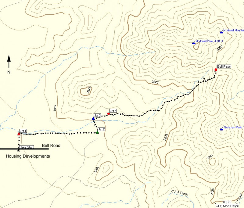
This hike is located in the McDowell Mountain preserve area and features an easy to follow trail with clearly signed trail junctions through the Sonoran Desert. The parking area is on the left side (North) of Bell road at the intersection of 104th street. Unfortunately, there is limited parking here. Parking in the desert center lane of Bell road is not recommended, as I have seen automobiles ticketed for doing this.
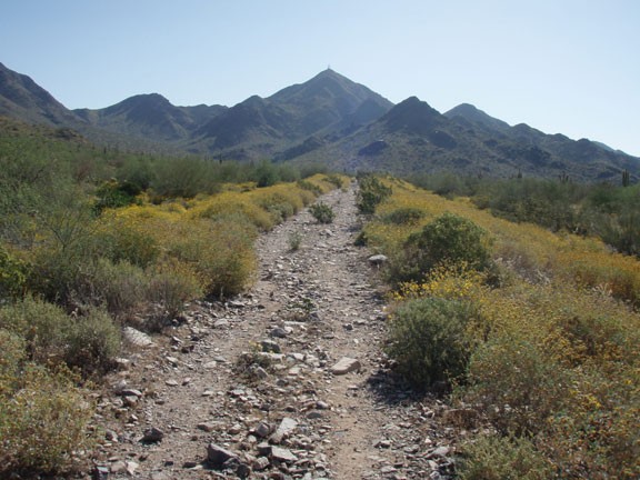
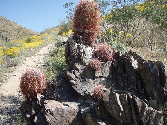
From the parking area take the dirt road (closed to vehicle traffic) North about 0.2 miles to the signed junction with the Levee trail (shown as Jct 1 on the map). Turn right onto the Levee trail as the trail turns due East and heads towards Bell Pass. As you walk along the Levee trail, it is easy to see Thompson Peak on the right of the pass and McDowell Peak on the left. The trail is easily followed for the length of this hike, although it can be rocky at times.
After about a mile, you'll reach the junction of the Levee trail and the Paradise trail (Jct 2 on the map). Turn left here onto the Paradise trail and hike another 0.2 miles across a desert wash to the junction with the Gateway Loop trail (Jct 3 on the map). Turn right here, following the signs for Bell Pass. There is one more trail Junction to negotiate (shown as Jct 4 on the map) after about 0.2 miles of hiking. Turn right here, again following the signs for Bell Pass.
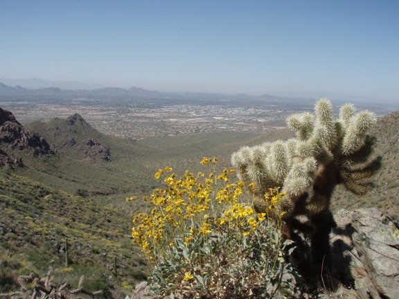
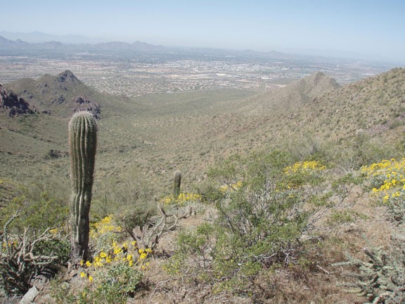
Now the route finding is behind us and the climbing begins in earnest. The trail gains elevation gradually for most of the climb, getting steep just before reaching the pass. Take your time here, as falling on the loose rock of this incline would be a bit uncomfortable. Soon your hard work is rewarded, with views of the four peaks to the East and views of Camelback mountain and North Scottsdale to the West.
The pass is a good place to take a break and soak up the views. When ready, return the way you came.
