
- Hikes in Arizona
- Phoenix Area and Central Arizona
- Lookout Mountain (Circumference Trail and Summit Trail)
Lookout Mountain (Circumference Trail and Summit Trail)


Location
In the Phoenix area, take state HWY-51 North to the Greenway Road exit. Turn left after taking the exit and head West. Greenway Road turns into Greenway Parkway. Stay on Greenway Parkway until you reach 16th Street. Turn left (South) onto 16th street and follow it to the trailhead at the base of Lookout Mountain. There is water at the trailhead, but no toilets.
Hike details
- Out and Back
- Loop
Season
- January
- February
- March
- April
- November
- December
- July
- August
Solitude
Difficulty
Permits
Hike up Lookout Mountain near Phoenix, Arizona.
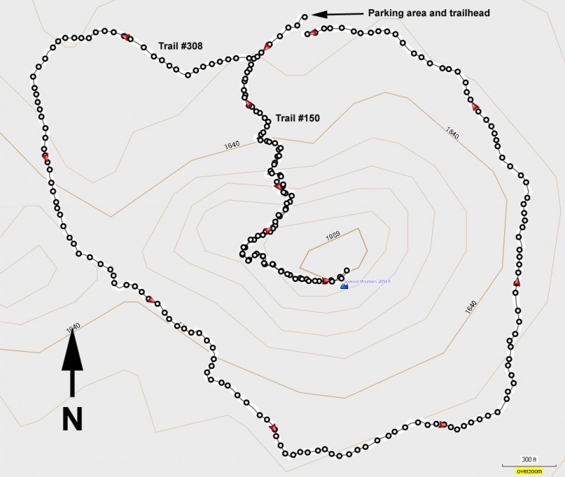
These trails start from the well signed parking area.
Summit Trail #150
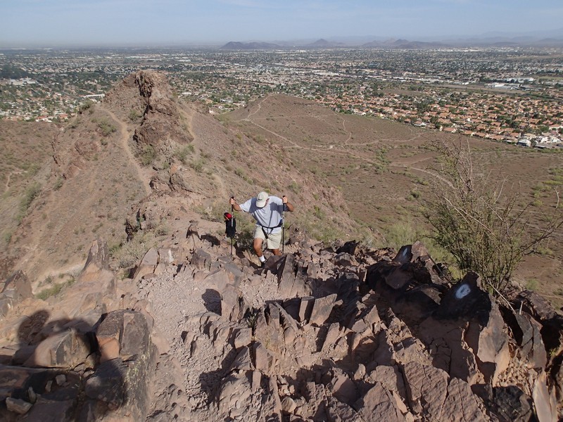
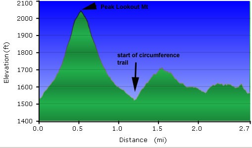
You will briefly be following the trailhead of #308 to your right before coming onto a sign marking the junction to trail #150. Follow the signed trailhead for #150. This trail heads up the side of Lookout Mountain facing the parking area. The trail climbs pretty steeply up to the top of Lookout Mountain. The trail starts out easy to follow, but as you climb higher on the mountain, there are several trails to choose from. Try to follow the signs at the junctions for #150. The trail at the top is rocky, but scrambling is not required. Eventually you end up on the short ridgeline at the top of Lookout Mountain. Views from the top of Lookout Mountain include Downtown Phoenix and the Phoenix Mountain Preserve to the south. Return the way you came.
Circumference Trail #308
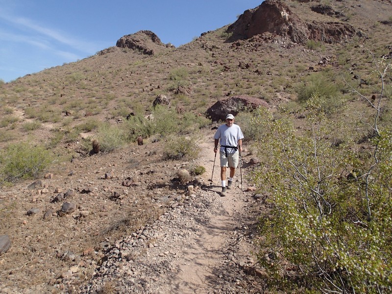
Follow the trailhead signs for #308. This hike description goes counter-clockwise. Although there are many trails that branch off towards the houses or towards the peak, the major trail junctions tend to have a sign pointing the correct trail. If a trail has a line of rocks across it, this is not the correct trail direction. Some route finding is necessary on the back side to stay on the trail, but even if you get off trail, it would be quite difficult to get lost. All you need to do is keep Lookout Mountain on your left.
This trail has significantly less elevation gain than the Summit trail, so hiking the 1.5 miles proceeds rather quickly. This hike passes a few Saguaros and if you're lucky you may see a Coyote like we did.
Enjoy!
