
- Hikes in Arizona
- Phoenix Area and Central Arizona
- Table Top Mountain
Table Top Mountain


Location
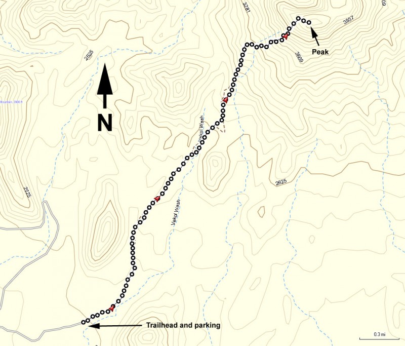
To get to the trailhead: From the Phoenix area, take I-10 South to HWY-347 (Maricopa Road Exit #164). From HWY-347, turn right on HWY-84 to I-8. Turn right on I-8 (West) and go to the Vekol Road exit (exit 144). Take the graded dirt Vekol Road south for 2.2 miles. From this point, keep your eyes out for brown trailhead signs on the right side of the road to help you navigate this area. The road is also signed as FR8024 to help you navigate. Bear right at the stop sign, driving 5.8 miles to a junction. Bear right once again and continue 3.1 miles. From this point, a high clearance vehicle is highly recommended. There is an old corral here where you will turn left (East). The road gets a bit sandy here as you continue another 0.8 miles to the next junction. Stay right here and go another 1.6 miles. Stay right once again and go 1.1 miles, where you will pass the trailhead to the South Lava trail. Continue 0.8 more miles to the Table Top camping area and trailhead. This road is not recommended after a rain.
Hike details
Season
- January
- February
- March
- April
- October
- November
- December
Solitude
Difficulty
Permits
Hike up Table Top Mountain near Phoenix, Arizona.
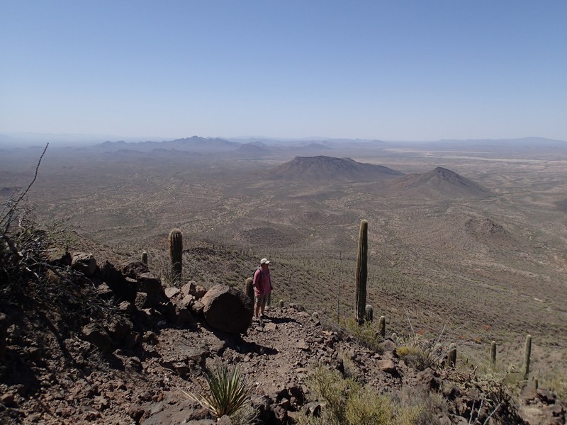
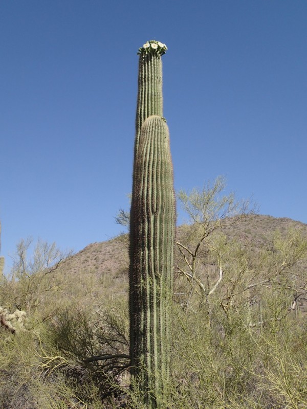
After parking at the day area, walk through the small camping area to the trailhead at the back. This hike starts out in a relatively flat area of Sonoran desert. Saguaros are particularly well represented here. The trail is wide and well marked as it heads towards the easily recognizable Table Top Mountain. Smaller mountains quickly surround you as the trail gently rises and closes in on the base of the mountain. The surrounding mountains show the evidence of volcanic forces, as well as the adaptation of the desert plants to this climate. Once you reach the base of the mountain, the trail climbs steeply, through a consistent series of switchbacks. Be sure to stop and look around once in a while during this stretch, as the views become more and more dramatic.
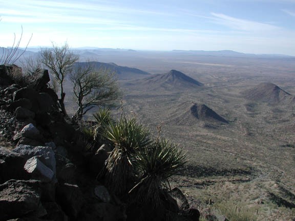
Just before reaching the summit, take note of the rock wall next to the right of the trail. Who built it? Why? Beats me. Best just to make up your own story like we did.
After about 3.7 miles and 2000 ft of climbing, you reach the top the mesa. The plateau is open for exploring, as different points open better views of the surrounding desert. After photos and snacks, return the way you came.
