
- Hikes in Arizona
- Phoenix Area and Central Arizona
- Hidden Valley (South Mountain)
Hidden Valley (South Mountain)


Location
To get to the trailhead: From the Phoenix area, take Central Avenue south into South Mountain park. Once you enter the park and after passing the stone buildings that mark the visitor center, drive the Summit Road for 4.7 miles. Turn right at the intersection and continue towards the Buena Vista parking area and drive another 0.7 miles. Make a left turn at this intersection and drive the remaining 0.4 miles to the trailhead parking. Drive slowly on these roads and watch out for bikers, hikers, and runners on the road. The trailhead starts at the parking area.
Hike details
Season
- January
- February
- March
- April
- October
- November
- December
Solitude
Difficulty
Permits
Hike Hidden Valley in South Mountain park in Phoenix, Arizona.
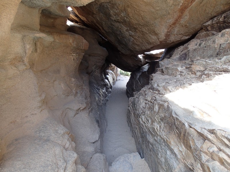
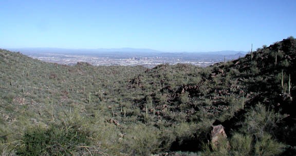
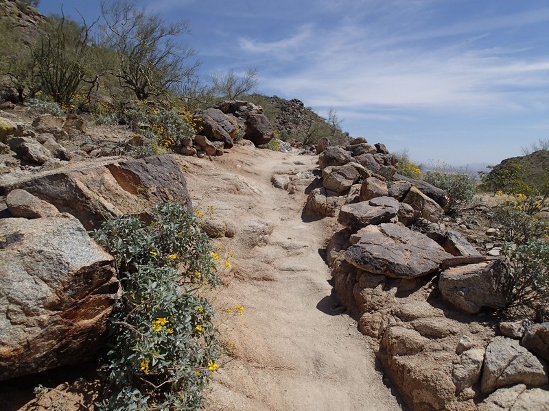
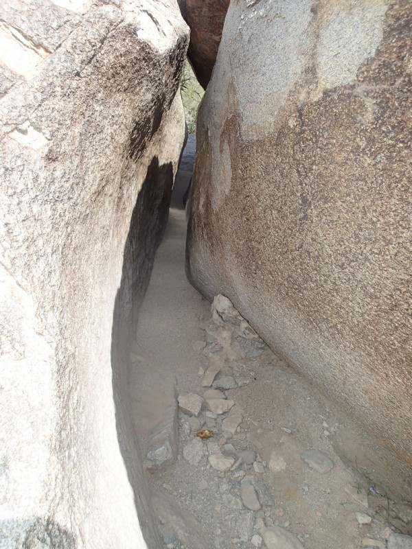
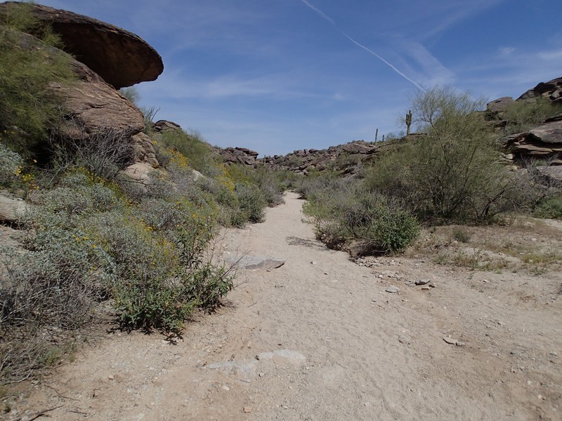
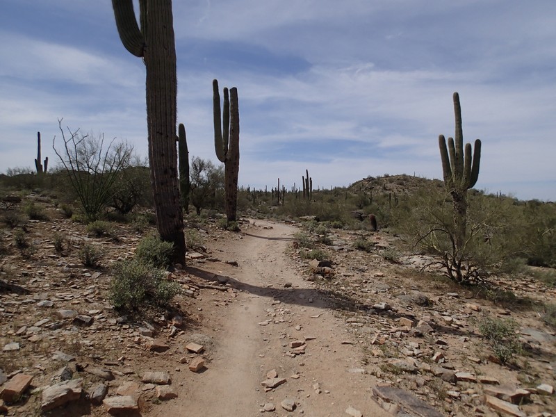
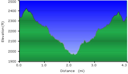
From the parking area, take the signed National Trail into the mountains. Views peek up between the mountains of the sprawling metropolis that makes up the Phoenix area. Impressive views of the downtown area and Camelback mountain follow as you walk down the well marked and gently descending trail. South mountain park has it's fair share of desert cactus, such as Saguaro and Barrel cactus. Keep alert on the National trail, as it is shared by mountain bikers and trail runners who are likely going much faster than you! After about 1.5 miles of hiking, you will find the signed intersection of the National Trail and the Hidden Valley trail (JCT 1R on the map). Turn right hear and try to shimmy your way through fat man's pass... removing your pack certainly helps. This section of the hike is much less crowded and accordingly more quiet as the trail heads down a desert wash. It could be possible to get turned around here, but if you stay in the wash, you'll be OK. There is a little scrambling here as well to spice up the hike.
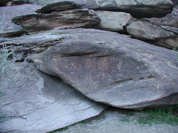
While hiking along the Hidden Valley trail, you'll pass through two tunnels before reaching the another junction with the National trail. Just after the second of the tunnels, keep your eyes out for some petroglyphs on the rocks. Turn left at the signed National trail junction (JCT 2L on the map) and hike another 0.2 miles or so to the signed junction with the Mormon Trail (JCT 3L on the map). Stay left here as well, keeping on the National Trail. From this point, the trail gains all the elevation you lost to this point by steadily climbing through the desert.
This is a particularly nice introductory Arizona desert hike. Enjoy!
