
- Hikes in Arizona
- Phoenix Area and Central Arizona
- Poland Creek
Poland Creek


Location
From the Phoenix area, take I-17 North to the Bumble Bee exit (#248). After driving on a paved road for a bit, this road (FR259) becomes good graded dirt. About 25 miles from I-17 (and 3 miles from the town of Crown King) just before and within site of mile marker 25, there is a pullout on the left side of the road. There is a small trail sign here. It may be difficult to see the trail here right away, but within about 100 yards of hiking, there is a sign and trail registration.
Hike details
Season
- March
- April
- May
- June
- July
- August
- September
- October
Solitude
Difficulty
Permits
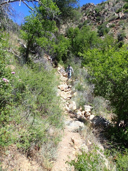
Hike to Poland Creek near Phoenix, Arizona.
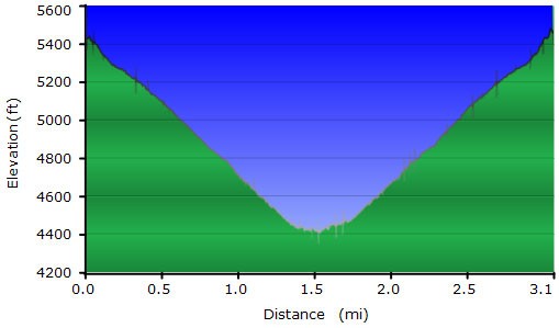
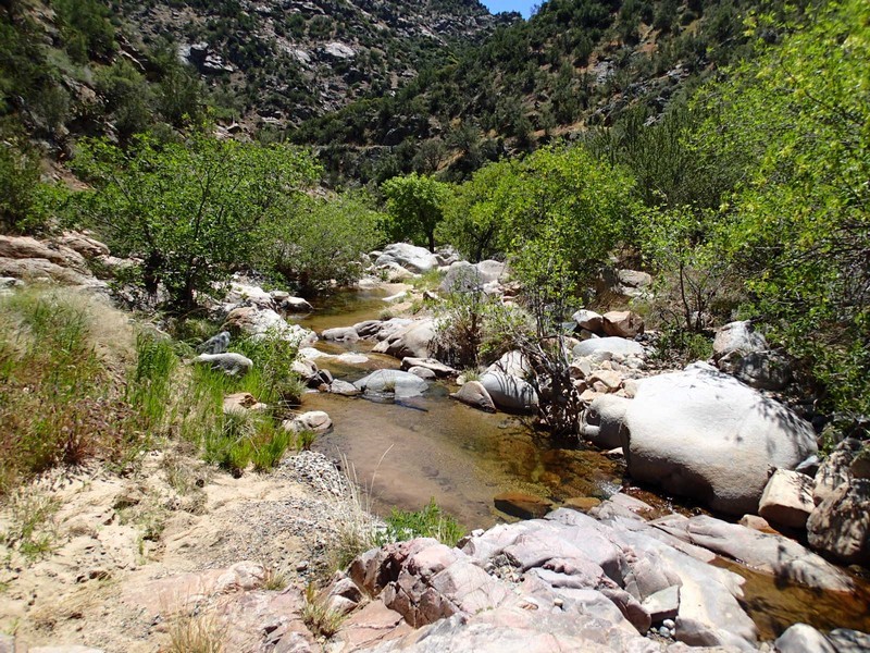
It's a pretty drive (and long) to get here, but once you start hiking off the FR259 road, the solitude quickly surrounds you. The trail drops 1000 ft into the canyon home of Poland Creek. Within the first few hundred yards, you will pass a few signs and a trail registration. The signs tell you that you are on the Algonquin Trail. The trail doesn't appear to get much use, but is easy to follow. We stumbled upon a happy sleeping rattlesnake who was napping right in the middle of the trail. Since there was no way around him, we had to ask him politely to move to another bed, which he did, but not without letting us know (via his rattle) that he wasn't happy about it.
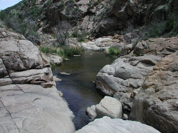
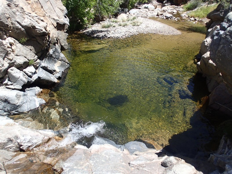
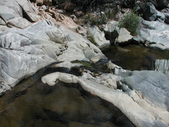
After walking down about 1.2 miles, the trail crosses Poland Creek. The trail continues up Horsethief Canyon and deeper into the Bradshaw mountains, but we left the trail here and headed downstream. Here the hiking turns to boulder hopping. During the spring, you can find pool after pool here, all looking inviting for a swim. We found what we thought was a nice swimming hole here and were about to dive in when we noticed a large bee hive in the tree overlooking the pool. We quickly relocated. Not to worry, there were plenty of pools to choose from.
After a lunch and a refreshing swim, we headed back up the 1000 ft climb to the car.
