
- Hikes in Arizona
- Phoenix Area and Central Arizona
- Cooper Forks Canyon
Cooper Forks Canyon


Location
To get to the trailhead: from the Phoenix area, take US-60 East towards Globe. Just after Miami and before globe, take HWY-188 left towards Roosevelt lake. Make a right onto well signed HWY 288. About two miles after crossing the Salt River, turn right onto Cherry Creek Road (signed as FR203), a well graded dirt road. You will continue to follow this road for 23.8 miles. Some waypoints follow (remembering to stay on FR203 the whole time):
After 8.8 miles, a sign for Coon Creek FR203 takes you across the creek and onto private property. Please respect this property so we can continue to have access to this area.
After 13.3 miles, a sign marks the road for Bull Canyon.
After 20.5 miles, you pass the Ellison Ranch. After this point, the road becomes 4WD mandatory. You need to cross Cherry creek here and depending on the season this could require a pretty good high clearance on your vehicle.
After 21 miles, you will see a sign that explains the "Sierra Ancha Cliff Dwellings" in this area.
After 22 miles you will pass the hiking start for Devils Chasm.
After 23.8 miles you will pass over a partially buried steel drainage pipe. Find a place to park, as the trailhead start is within 100 ft of this pipe.
Please do not underestimate this road. Getting stuck out here would be a lonely experience.
Hike details
Season
- January
- February
- March
- April
- October
- November
- December
Solitude
Difficulty
Permits
Hike to the Cooper Forks canyon ruins in Arizona.
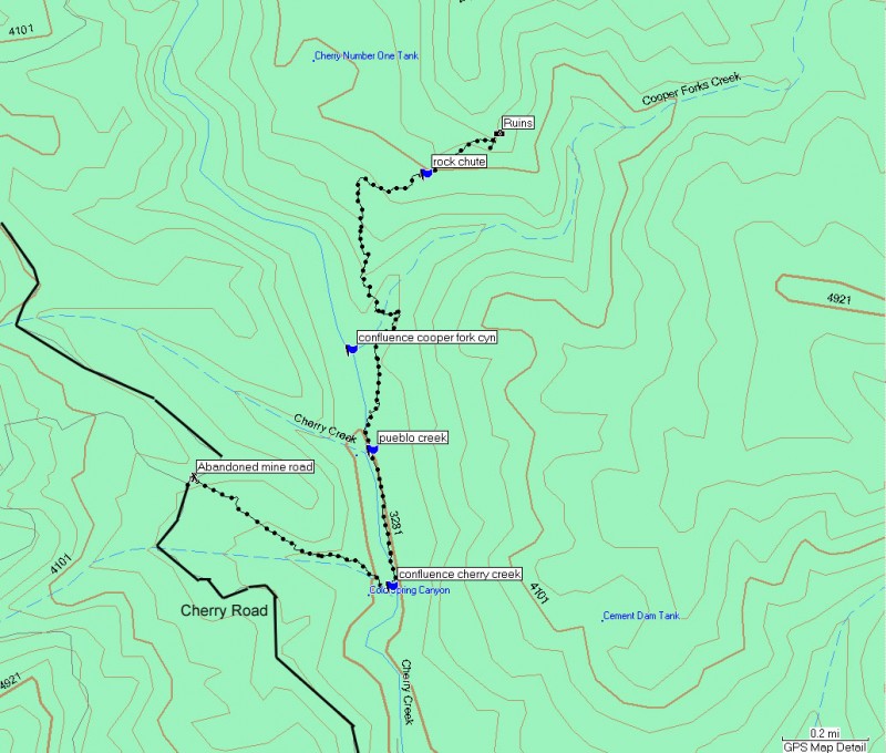
GPS coordinates of waypoints:
Start of Hike at abandoned mine road: N33 50.327 W110 52.032
Confluence with Cherry Creek: N33 50.104 W110 51.551
Pueblo Creek confluence: N33 50.379 W110 51.600
Our crossing point of Cooper Forks
(not shown on map): N33 50.661 W110 51.572
Rock chute: N33 50.938 W110 51.469
Ruins: N33 51.023 W110 51.289
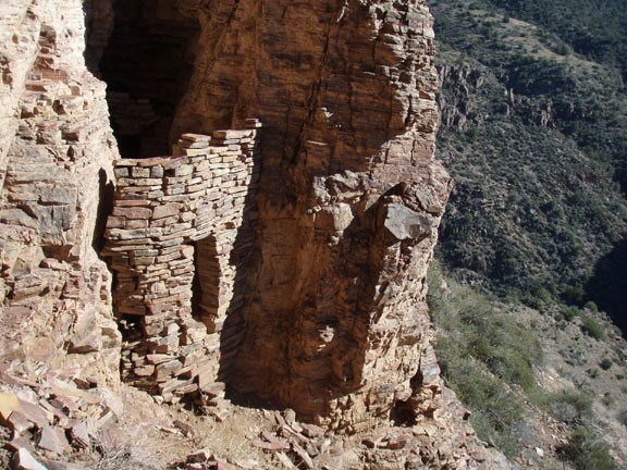
The impressive ruins that are the destination for this hike were built and occupied by the Salado Native Americans between 1280 and 1350 AD. You will appreciate these ruins even more as a result of the tricky approach needed to reach them.
The hike starts at the old mining road leading down to Cherry Creek. Look on the right side of the road (towards Cherry Creek), you'll see a dirt track that has been overgrown over the years. Head down this track. Enjoy this while it lasts, as it is the most clear trail you will get on this hike.
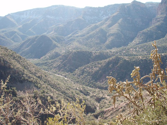
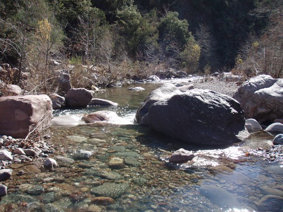
After about a quarter of a mile, the road finishes its decent into a wash called Cold Spring Creek (usually a dry wash). From here, start boulder hopping and bush whacking down the wash until you reach the easily recognized Cherry Creek confluence. There is a cairn marked path that follows along Cherry Creek and is easier than boulder hopping and bush whacking along the creek. However, Cherry Creek is a perennial creek, so you'll have to cross the creek to get to the trail. I'm calling this a trail, but it is more like a route. There will be some bush whacking and route finding to stay on this cairn marked path. Stay on the right side of the creek (while looking upstream) for this section of the hike.
After you pass the confluence of Pueblo creek coming in from your left, the path you have been following starts to gain in elevation to avoid a narrowing of Cherry Creek. Continue following the cairns as best you can until you reach Cooper Forks Creek coming in to Cherry Creek from the right side. This is the trickiest route finding of the hike. You need to find a way across Cooper Forks Creek (from the East side of the creek to the West side). We were unable to find a well marked route, so expect bushwhacking and scrambling down and back up the other side.
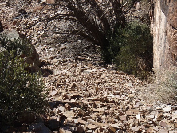
On the north side of Cooper Forks Creek there are several cairned paths to the ruins. All are tough to follow in spots and can require some scrambling. These paths lead to a tough section that looks like a chute. The chute is filled with flat rock chips, making this a tough climb with uncertain footing. On the bright side, from this point it is much easier to follow the short remaining trail to the ruins.
The ruins here are pretty well preserved. There are about six rooms here (including a 2 story section) to observe. There are also pottery shards and corn grinding stations around, so watch your step. Spend some time to explore around here and appreciate the ruins, but keep in mind that these ruins are extremely fragile. Your care will enable others to enjoy this unique area as well.
Return by the same route.
