
- Hikes in Arizona
- Phoenix Area and Central Arizona
- Ben Avery Trail
Ben Avery Trail


Location
To get to the trailhead: from the Phoenix area, take I-10 West towards Quartzite, AZ. About 68 miles from Phoenix, exit the I-10 at the Harquahala Valley Rd exit (exit #81, also signed as Salome Rd.) and make a left (South). Stay on the Harquahala Valley road by making a quick right turn after crossing the overpass. Drive 5.5 miles south to the intersection of Harquahala Valley Road and Courthouse Rock Road (also Centennial road). Turn right onto Centennial road, which is good graded dirt. Follow this road for about 7 miles until the road splits at a natural gas pipeline road. There is an information sign for the Eagletail mountains wilderness area here to mark this split. Bear right here and take the natural gas pipeline road another 4.0 miles to well signed FR013 and make a left on to this road. Drive the final 1.5 miles to the trailhead. Because the road is crowned here and crosses desert washes in places, a high clearance vehicle is a good idea.
Hike details
Season
- January
- February
- March
- November
- December
Solitude
Difficulty
Permits
Hike the Ben Avery trail near Phoenix, Arizona.
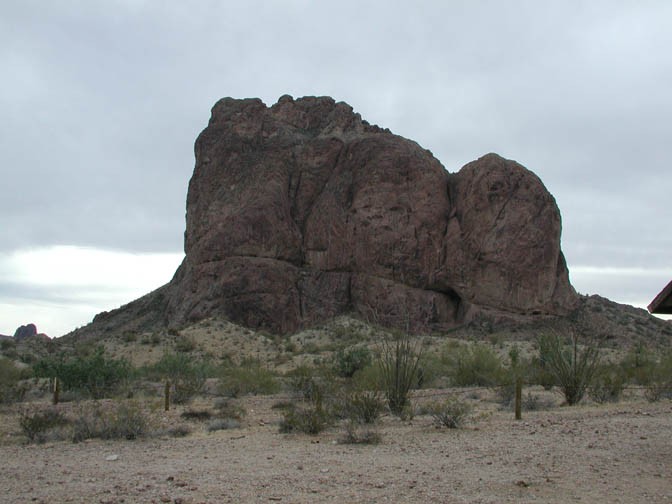
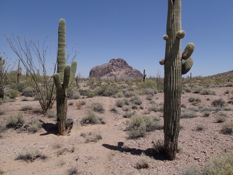
There is some peaceful and pristine desert west of the Phoenix area. The Eagletail Mountain wilderness area contains plenty of Saguaro, Cholla, Palo Verde, and all those other wonderful desert plants. The hike starts in the shadow of the majestic Courthouse Rock (to your left as you start the hike). I've included a more detailed description because there are a number of jeep trails in this area and it's easy to take the wrong one. I've also included GPS coordinates (in parenthesis) in case you are having problems finding the spring. A topo map would be a good idea here.
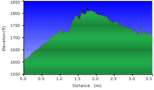
Miles Description
0.0 Start of Trailhead via an old jeep road.
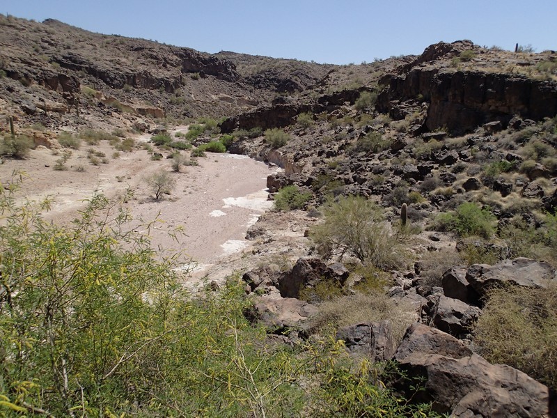
0.9 The jeep road enters a wash. Hike in the wash from here (Leave Wash Right on map)
1.6 After crossing a cattle fence blocking the wash, leave the wash and return to a jeep trail on your left. (N33 27.490 W113 22.701) (marked as FENCE on map)
2.2 The jeep trail returns to a wash and follows along side the wash.
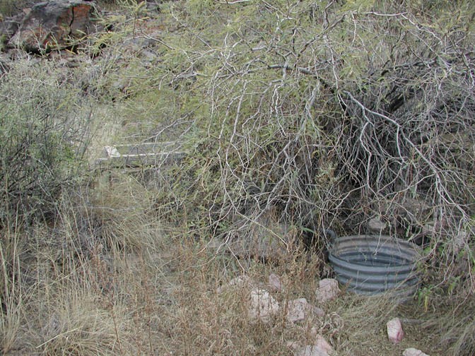
3.0 The wash splits here. Follow the left and immediately start watching the right bank. (N33 26.620 W113 23.759)
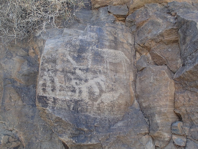
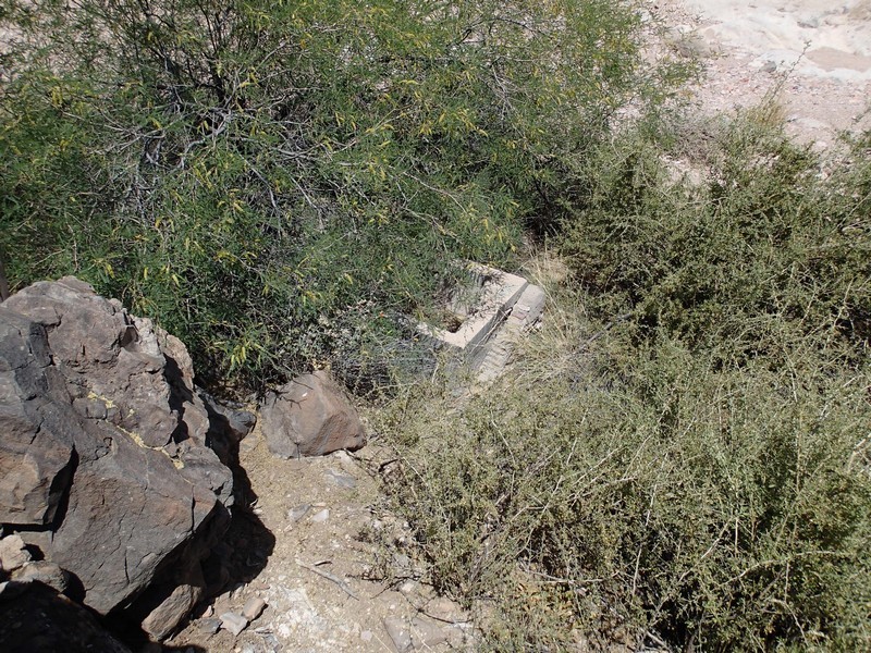
After reaching the 3.0 mile mark, follow the wash to the left while keeping your eye on the right bank. Hidden under some brush is the old spring (pictures below). The last time I took this hike, the metal pan was gone but the cement trough was still there (but mostly hidden by brush). On the left of the bank are some rocks with petroglyphs on them. This is a good turn around point for this hike.
If you accidentally make your way right at mile 2.2 along another jeep trail (like we did), you may run into a game tank. While the game tank is interesting, it's also a good sign you turned the wrong way.
Return by the same route.
