
- Hikes in Arizona
- Phoenix Area and Central Arizona
- Pass Mountain Trail (Usery Mountain park)
Pass Mountain Trail (Usery Mountain park)


Location
From the Phoenix area, take the Loop 202 East to the McKellips Rd exit and head East (left). When you reach the intersection with Ellsworth road, turn left (North) on Ellsworth Road. Ellsworth Road turns into Usery Pass Road. Follow this road about two miles to the entrance of the Usery Mountain Recreation Area. Turn right to enter the park. After you have paid your entrance fee ($6 as of April 2013), follow Usery Park Road to Wind Cave Drive. Turn left on Wind Cave drive (one way) and park. There is a restroom and water at the trailhead. Parking can get crowded on weekends.
Alternate trailhead: Continue past Wind Cave drive about 0.4 miles and turn left at the 'Horse Staging Area' sign. There is more parking here. Look for the sign for the Pass Mountain Trailhead and start the hike here.
Hike details
Season
- January
- February
- March
- April
- October
- November
- December
Solitude
Difficulty
Permits
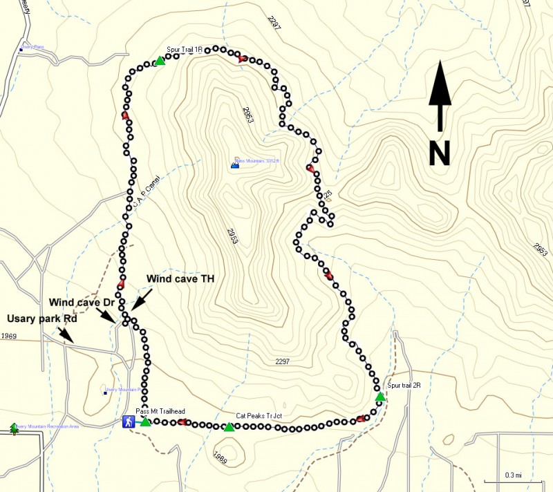
Hike the Pass mountain trail in the Usery Mountain park near Phoenix, Arizona.
This trail is well marked and just North of the East Valley. These two facts make it a very popular area on weekends. Parking close to the trailhead could be a problem, but what does an extra few feet mean for a hiker anyway?
There are two trails at this area. The Pass Mountain trail circles the mountain, while the Wind Cave trail hikes up it's face. Most people here are headed for the Wind Cave trail route. This loop describes the Pass Mountain Trail.
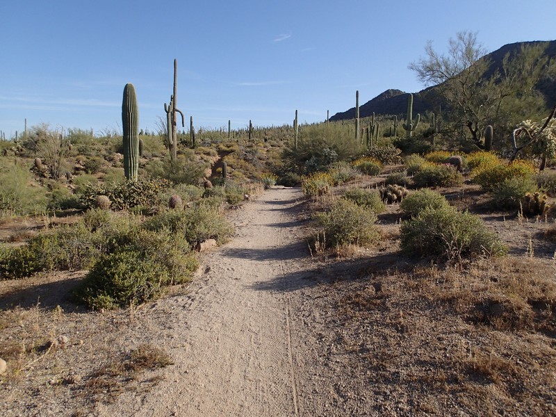
The well marked and well signed trail heads away from the parking area and leaves most of the crowds behind quickly. This section of trail has some short up and down bits through washes but is mostly flat walking. The Saguaro's are pretty dense in this area. Stay right at any spur trail (two of them are shown on the map as Spur Trail 1R and Spur trail 2R).
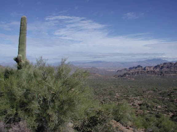
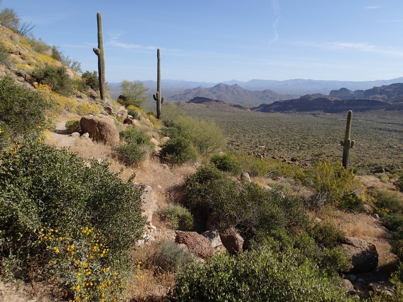
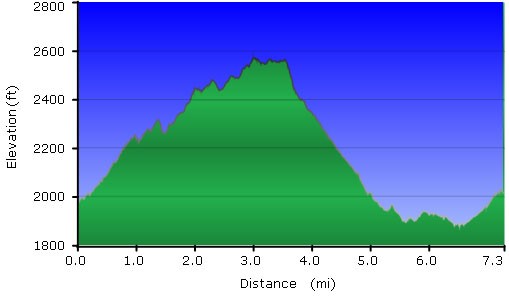
The trail loops around Pass Mountain first to the east, then back south. As the trail turns from east to south, good views are found to the surrounding areas. The trail climbs slowly here and begins to hug the side of Pass Mountain. It is easy to forget that you are close to a desert metropolis here, as there are no signs of civilization. This is without question the most enjoyable part of this hike. The climbing tops out at a pass where you can see north Mesa ahead of you and the untouched desert behind.
From here, the trail descends rather quickly and continues to hug the mountain while winding back to the trailhead. Views of pricy Mesa houses come into view, signaling you are nearing the end of the hike. Be aware of mountain bikers on this last stretch. The entirety of this trail is open to mountain bikers, but I wouldn't want to try it. There are a number of spur trails in this section. If you stay right (close to Pass Mountain) you'll be fine. Stay right at the signed trail junction with the Cat Peaks trail and then stay right again at the signed junction with the Pass Mountain Trailhead junction (unless you started the hike there as the alternate trailhead).
