
- Hikes in Arizona
- Phoenix Area and Central Arizona
- Cave Creek Loop hike (Cave creek trail and Skunk Tank trail)
Cave Creek Loop hike (Cave creek trail and Skunk Tank trail)


Location
To get to the trailhead: from the Phoenix/Mesa area, take HWY-101 North to the Pima Road exit. Take Pima road North to Cave Creek Road. Turn East (Right) on Cave Creek Road. Soon, there will be a Tonto National Forest sign on the right (This is about 6 miles from Carefree). From this point, this road becomes FR 24. Continue 12.2 miles from the Tonto National Forest sign to the Cave Creek Trailhead parking area (next to the campground). FR 24 is graded dirt and passable to all vehicles, although you might want to leave that new Mercedes in your garage. As of April, 2013, this area requires a Tonto pass, which costs $6 and is available throughout the Phoenix area.
Hike details
- Water
- Wild Flowers
Season
- January
- February
- March
- April
- May
- October
- November
- December
- July
- August
Solitude
Difficulty
Permits
Hike the Cave Creek Loop made up by Cave Creek trail and Skunk Tank trail near Phoenix, Arizona.
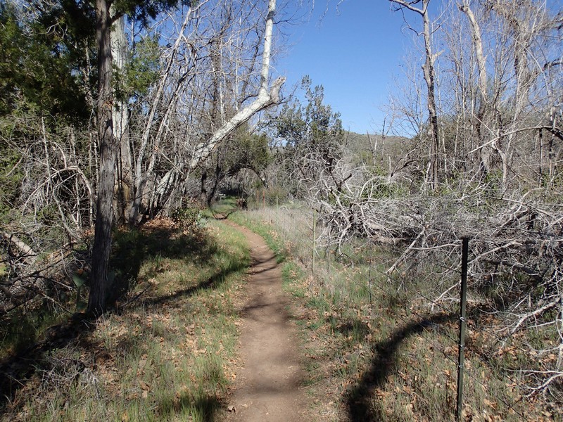
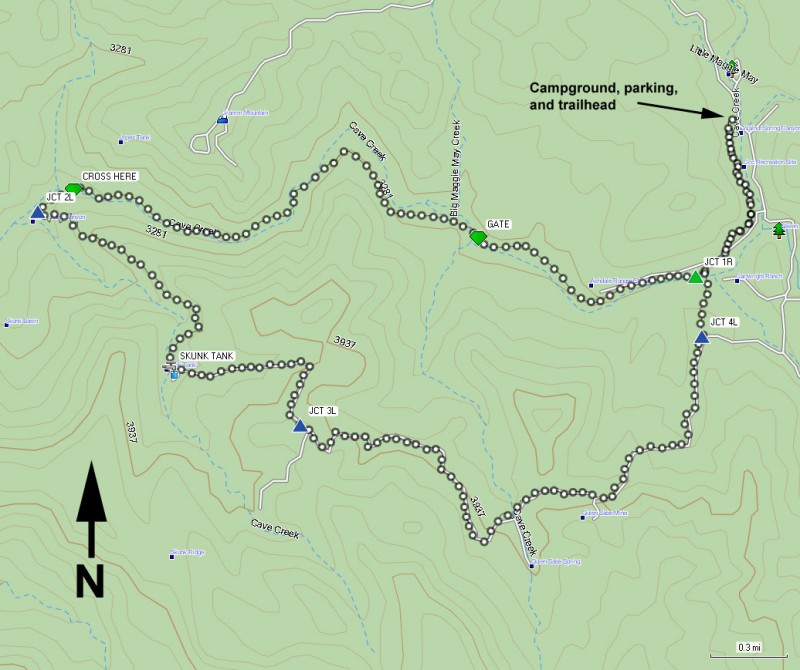
The hike starts at the Cave Creek Trailhead parking area. The trail starts south, passing the campgrounds and an access road before it reaches Cave Creek 0.5 miles from the parking area. For the loop hike described, head South along the Cave Creek Trail #4.
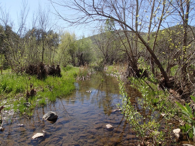
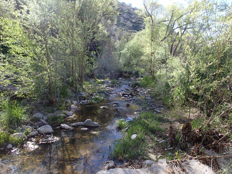
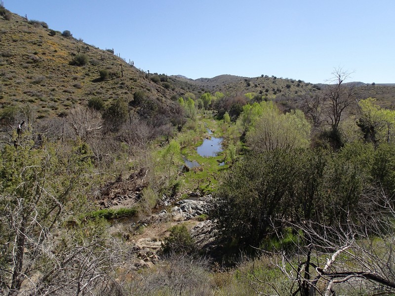
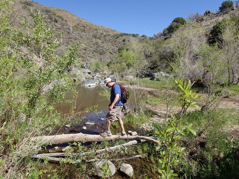
This trail follows the creek, even crossing it a few times. The walking here is mostly flat and pleasant. This is one of those rare locations in Arizona where water flows year round, and the surrounding vegetation is reflective of that. Impressive shade trees including Walnut, Ash, and Sycamore shade the hiker on this trail. There are also some good photo opportunities here, so bring your camera. You'll pass a trail junction sign for the Skunk Tank trail (Jct 1R on the map). Continue straight here, following the creek.
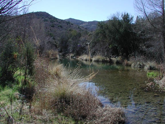
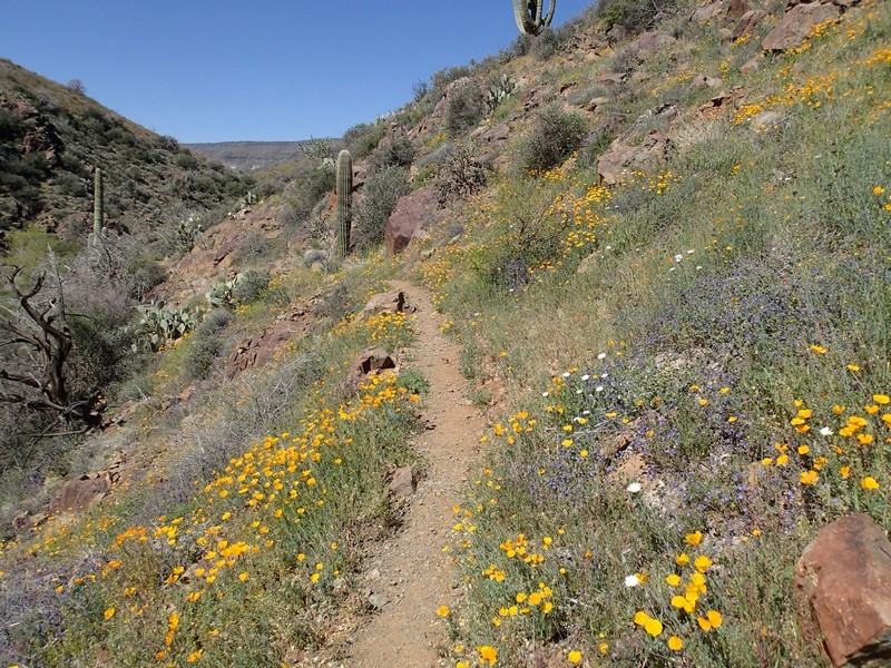
After about 4.0 miles of hiking on the Cave Creek Trail, the trail crosses the creek for the final time and you reach the signed junction of the Cave Creek Trail and the Skunk Tank Trail (Jct 2L on the map). Be alert here, as the Cave Creek Trail continues for a total of 10.5 miles and you could miss the creek crossing if you aren't looking for it. The junction of the Cave Creek Trail and Skunk Tank Trail is well marked. Once on the Skunk Tank trail, the trail quickly switchbacks up one side of Skunk Tank Canyon. The total elevation gain of this hike is in the next 1.5 miles of this trail. As the trail goes higher, you are greeted with more and more views of the surrounding desert. Now the vegetation turns to the more traditional desert cacti of Saguaro and Cholla. Eventually, you'll pass signed Skunk Tank, which is a brackish oasis. This is a particularly colorful area to hike through during the spring wildflower season.
After about 2.5 miles on the Skunk Tank Trail, you reach the signed intersection of the Quien Sabe Trail (Jct 3L on the map). Stay left and continue on the Skunk Tank trail, which now becomes an old mining road. The walk begins to lose the elevation that was gained earlier as you get closer and closer to Cave Creek. The trail ends 2.3 miles later at the signed junction with the Cottonwood Creek Trail (Jct 4L on map). Turn left on this trail to get back to the creek and follow the Cave Creek trail back to the parking area.
