
- Hikes in Arizona
- Phoenix Area and Central Arizona
- Picketpost Mountain
Picketpost Mountain


Location
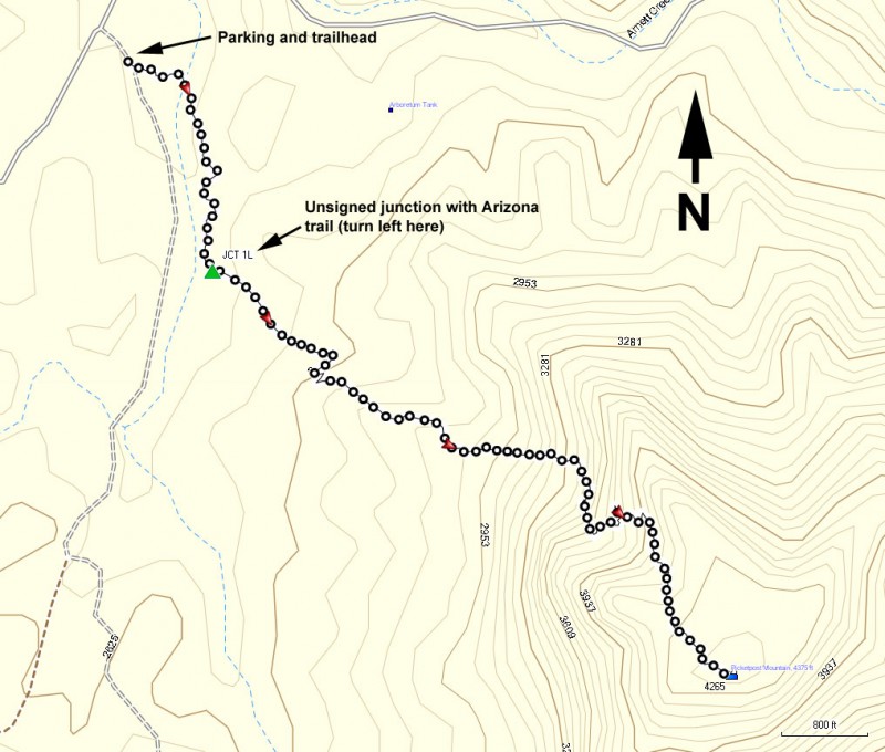
To get to the Trailhead: From the Phoenix area, take US-60 East toward the town of Superior. Between mile markers 221 and 222, turn right on FR231 (a windmill marks the road on the right) and is also called Uno Trail. If you get to the Boyce Thompson Arboretum, you've gone too far. Take FR231 0.3 miles to a T intersection. Turn left onto FR310 (also known as Saddleridge trail). The signed Arizona Trailhead is 0.6 miles from this point. There is plenty of parking and pit toilets.
Hike details
Season
- January
- February
- March
- April
- September
- October
- November
- December
- July
- August
Solitude
Difficulty
Permits
Hike to the top of Picketpost peak near Superior, Arizona
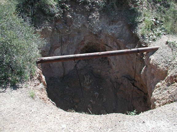
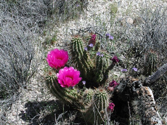
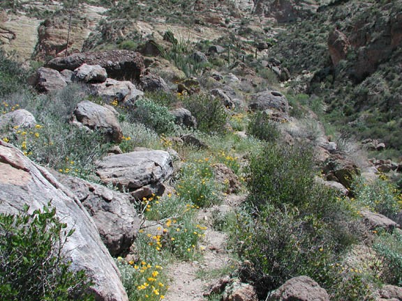
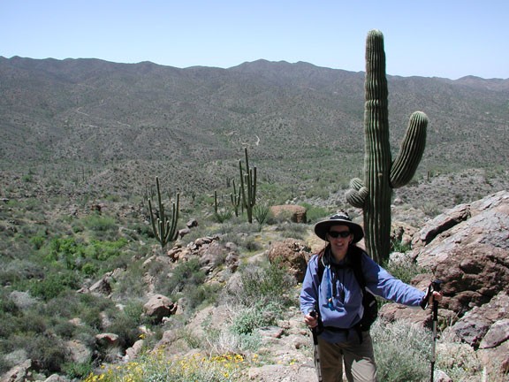
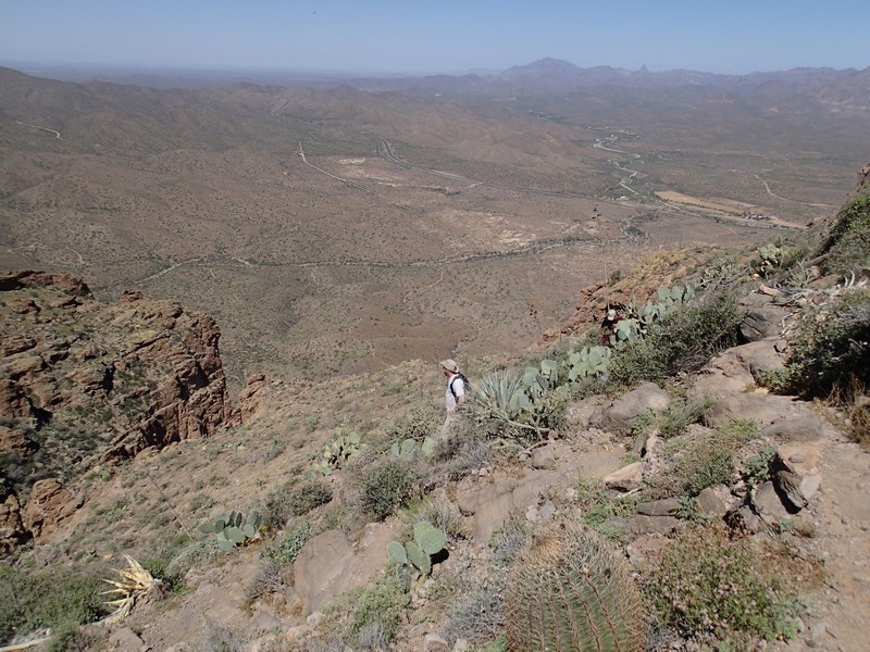
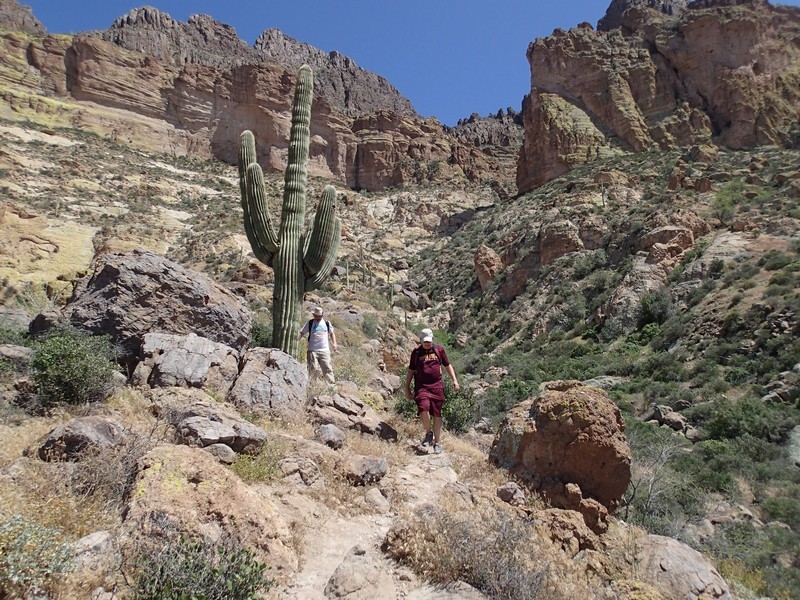
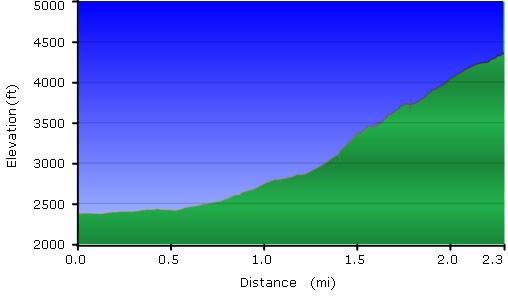
The hike starts on the Arizona Trail, but doesn't stay on it long. After about 0.55 miles, there are some Cairns marking an unsigned trail (JCT 1L on the map) that crosses a wash and heads directly towards Picketpost Mountain. Make a left onto this Cairn marked trail. After a hundred yards, this trail turns into an old jeep road that ends after about 0.1 miles at an old mine shaft. When we did this hike back in 2003, the mine shaft was open, but now it has been sealed. Here the Picketpost trailhead starts. The climb is steady along the ridgeline. The footing can be a bit slick on some of the loose rock. There are some parts here that require some scrambling as well. You will get a good workout on this hike. On the way up, take the time to enjoy the increasingly impressive views, as well as the multitude of desert wildflowers. After hiking and scrambling 1.6 miles later, you've reached the peak and killer views.
To the north, you see a rare view of Weavers Needle and the Superstition Mountains. To the East, you can see the town of Superior, Queen Creek, and the Magma Mine area. To the South and West are more mountains and desert trails ringing the area.
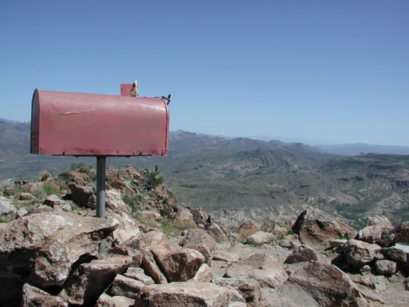
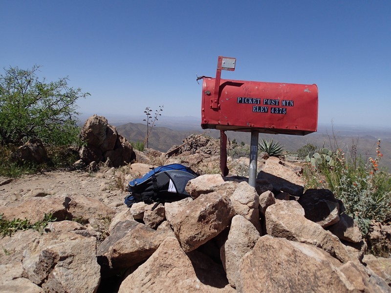
There's a mailbox at the top of this climb with an impressive history engraved on it's mouth. Take the time to read about it and add your comments to the guest book. The top of a mountain peak is always a great place for lunch.
On the way back down, watch your footing and enjoy the hike. If you have time, you might want to check out the Boyce Thompson Arboretum a few miles up the road towards Superior.
