
- Hikes in Arizona
- Mogollon Rim
- Gordon Creek Waterfall
Gordon Creek Waterfall

Location
From the Phoenix area, take HWY 87 North towards Payson. Once in Payson, take HWY 260 east toward the town of Christopher Creek, AZ. About 25 miles from Payson, near mile marker 277, make a right turn on paved Colcord Road (FR 291). Drive 1.3 miles and park next to the telephone line on the right side of the road.
Hike details
Season
- May
- June
- July
- August
- September
- October
- January
- February
- December
Solitude
Difficulty
Permits
Hike to the Gordon Creek Waterfall on the Mogollon Rim in Arizona.
It is quite rare that you can find a good swimming hole in Arizona during the summer months. It is even more rare that you can find one with any solitude. Swimming and solitude is why we found the hike to the Gordon Creek waterfall so enchanting.
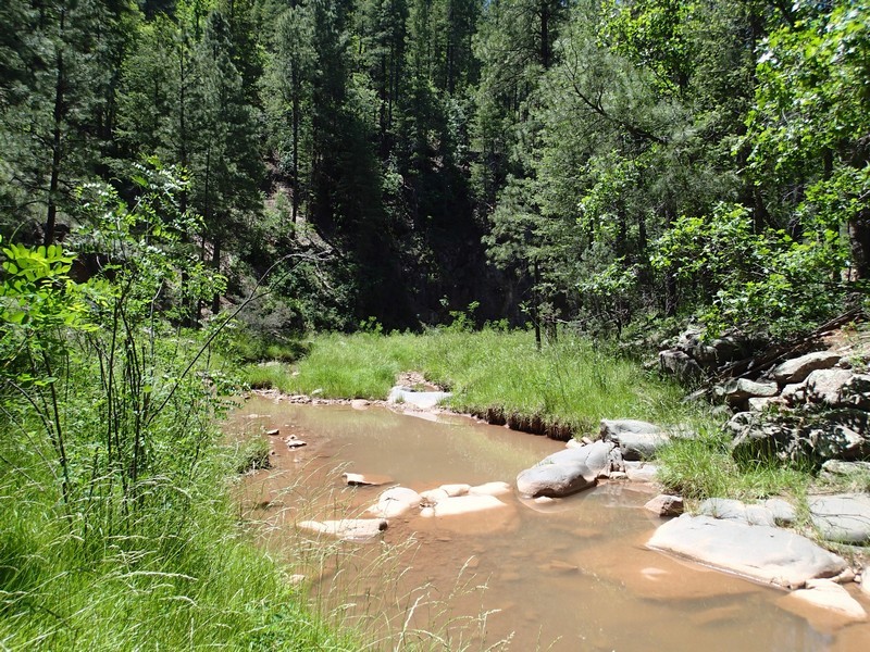
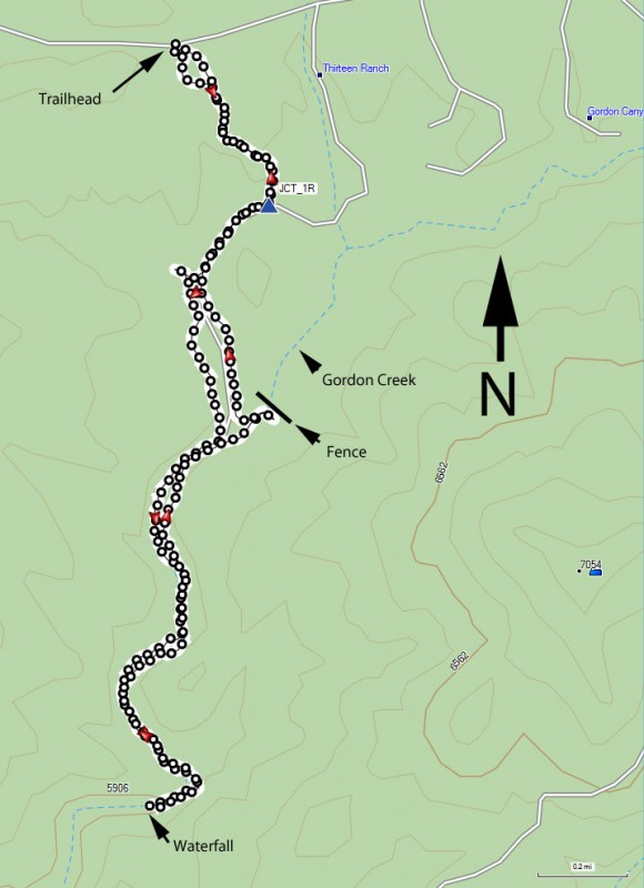
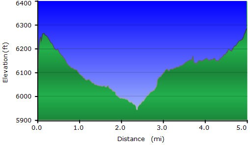
From the parking area, walk about 20 yards down the road to the unmarked dirt road, marked with a closed sign when we were there. Hikers can duck under the gate and walk along the old jeep road towards the creek. Its about 1.2 miles of walking along this jeep road through a pine forest before reaching the creek. This section requires some route finding, as there are other jeep roads that branch off from the main road. Try to stay on the road that looks like the main one that heads generally South East and continues to loose elevation and you should be OK. A topo map would be helpful here. Stay right at the road junction shown on the map (JCT_1R).
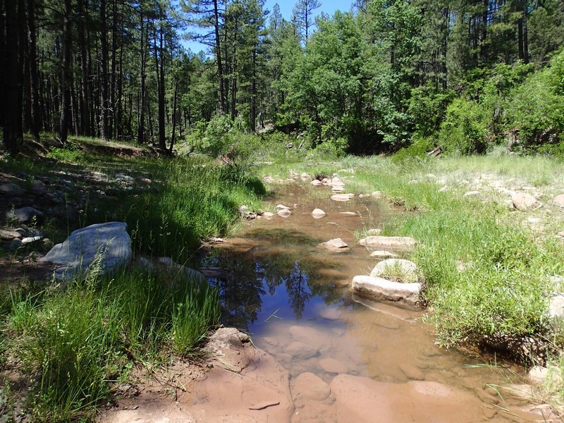
After about 45 minutes of hiking, you should reach the creek. When we did this hike in June, the creek didn't have much water in it, but don't let that deter you. The road you are on crosses the creek three times and eventually ends up on the right side (looking downstream) of the creek. When you see the road begin to gain elevation here, leave the road and begin walking down the creek. There is also a very nice campsite (creek right while looking downstream) here to mark this point. Spend a few moments looking around here and remembering the scenery, as you need to recognize this point on the way back to pick up the jeep road on your way back.
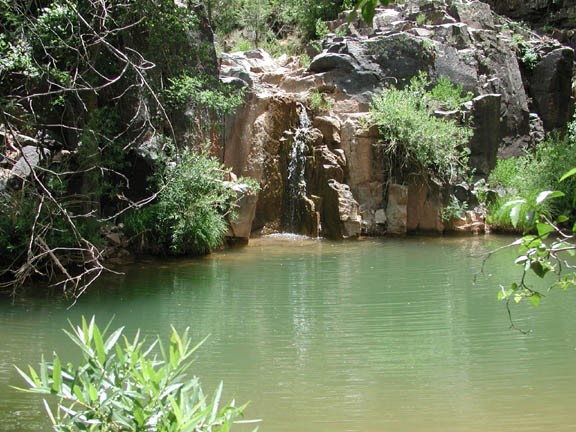
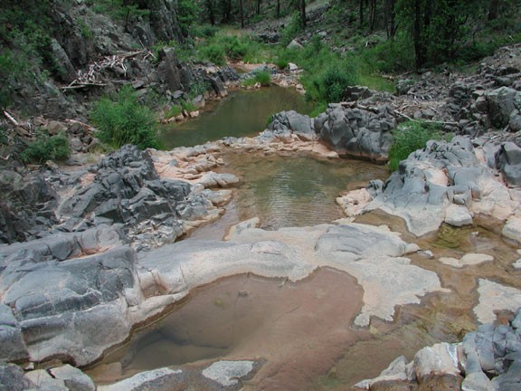
From this point, progress down the creek is made by rock hopping, bushwhacking, or taking short game trails. You can keep your feet dry the entire time if you wish and the bushwhacking is not bad at all. The creek also becomes more interesting here, as it forms several pools and contains notably more water and more foliage. There are a number of animal tracks in this area, indicating the popularity of this creek as a water source for the creatures in the forest. After about 0.8 miles from the point you left the road, you will encounter the waterfall and obvious swimming hole.
Looking downstream, there is a route to the pool with a scramble on the right. Do not jump into the pool from the top of the waterfall! The deepest point of this pool is only about 8 ft. This pool is in a lovely location and makes for a refreshing swim on a hot day. Feel free to enjoy this wonderful place for as long as you like.
When you have had your fill of swimming, return the way you came.
