
- Hikes in Arizona
- Mogollon Rim
- Horse Crossing - East Clear Creek
Horse Crossing - East Clear Creek
Location
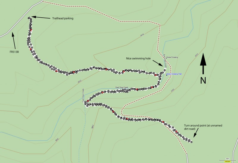
To get to the trailhead: from the Phoenix area, take HWY-87 Northeast through Payson, Pine, and Strawberry towards Winslow, AZ. After passing Lake Mary Road (FH3), drive an additional 9.4 miles, turning right onto FR 95 (just before mile marker 300). Drive on well graded dirt road FR 95 for 4 miles, turning left onto FR 513B. Drive 2 more miles on the high clearance road FR513B until you see the small pullout and the trailhead sign (Horse Crossing Trail #20) on the right. FR 95 and FR 513B are not recommended after (or during) rain.
Hike details
Season
- June
- July
- August
- January
- February
- December
Solitude
Difficulty
Permits
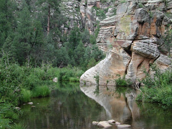
Hike along the Horse Crossing trail across East Clear Creek in Arizona.
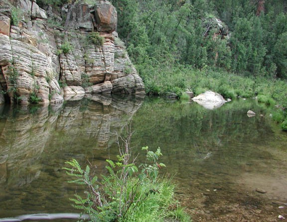
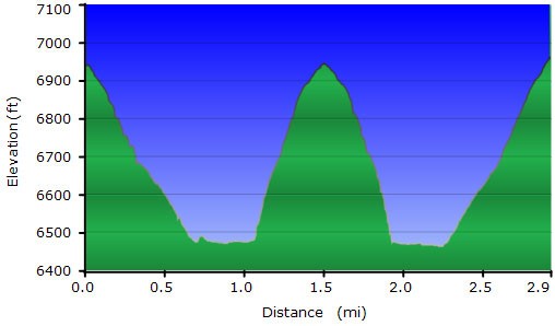
Starting from the trailhead, this well worn path descends through a pine forest down to the canyon bottom. After 0.75 miles, you reach the creek and a fork in the trail. To continue on the Horse Crossing trail, turn right here and follow along the creek. If you turn left here, there is a very nice swimming hole about 200 ft walk from this point. The swimming hole has a sandy beach and reasonably deep water. It's an excellent place to spend a few summer hours cooling off.
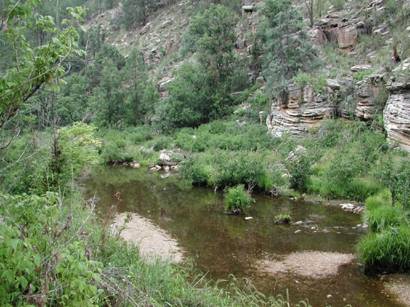
From the creek, continue right as the trail quickly disappears. You can either walk in the shallow creek itself, or stick to the right (North) side of the creek for about 0.1 miles where there is a place to cross without getting your feet wet. Once on the South side of the creek and after hiking 0.25 miles from where you first reached the creek, keep your eyes on the left (South) side of the canyon. You will see a side canyon start to open up. Six feet off the ground on one of the trees is a trail arrow sign (only about 6" x 6") showing the trail up the South side of the canyon. This is very easy to miss, so keep your eyes open.
The trail starts a steeper ascent of the South side of the canyon, eventually topping out after 0.5 miles of hiking to a forest road and the turn around point of this hike. When we did this hike, this point was unusually peaceful. This part of the trail looked to be sparsely traveled. There was significant evidence of animal activity here.
After enjoying the peaceful solitude, head back down the canyon to the creek. Watch your footing along the overgrown creek. When we did this hike, we interrupted a rattlesnake looking for his morning meal. He was polite enough to rattle and let us know we were too close so we could take a different route.
Backtrack to the pool, bring your swim suit (or not!) and enjoy the cool, refreshing dip. After you have thoroughly enjoyed yourself, head back up the North side of the canyon to your car.