
- Hikes in Arizona
- Mogollon Rim
- Willow Valley
Willow Valley


Location
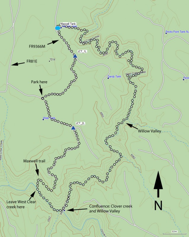
To get to the trailhead: from the Phoenix area, take HWY-87 North toward Payson. Go through the towns of Payson, Pine, and Strawberry while staying on HWY-87. About fifteen miles after Strawberry, take Lake Mary Road (also known as FH-3) North past Clint's Well and towards Happy Jack. Ten miles after passing Clint's Well, take FR81 West. On FR81, drive 3.1 miles to a fork. Turn left at this fork to get on FR81E. Take FR81E for 3.8 miles to a fork with FR693. Stay left at this fork and in another 0.5 miles, you will be at the junction of Maxwell Trail Road and Maxwell Tank Road. Park here to start the loop.
Depending on the weather conditions, High clearance vehicles are recommended. I managed to get my 2 wheel drive truck stuck in the mud here after some Spring rains. Later in the summer, the roads were dry and flat enough for passenger cars.
Hike details
- One way - Shuttle
- Loop
Season
- June
- July
- August
- January
- February
- December
Solitude
Difficulty
Permits
Loop hike through West Clear Creek and Willow Valley on the Mogollon rim in Arizona.
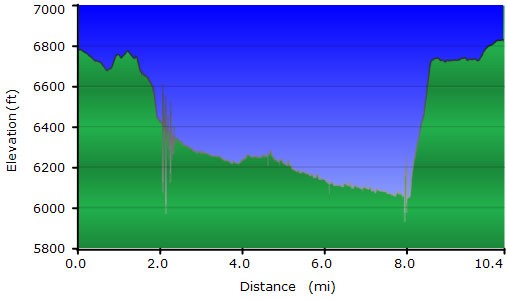
The hike starts along the graded Maxwell Tank Road. Walking along this flat, forested road is a nice warm up to the fun ahead. After one mile of hiking, bear left at the fork (JCT_1L on the map) and walk another 0.4 miles to Maxwell Tank. Walking around to the back of the tank leads you to a drainage with a faint trail. Stay in the drainage even though you need to battle the New Mexico Locust plant (ie: sticker bush!). When we did this hike, we brought a long sleeve shirt and long pants just for this part to defeat the sticker bushes. After we made it to the bottom of the canyon, these clothes went back into the pack for the hike duration. Gaiters are a plus here. The hike down this drainage is tricky only because there are periodic scrambles, but nothing that needs ropes. Follow this drainage 0.4 miles to the base of Willow Valley.
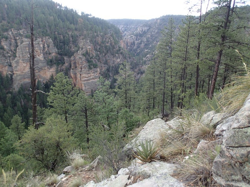
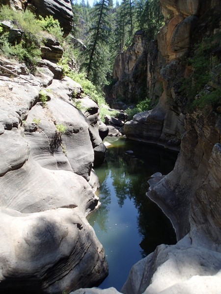
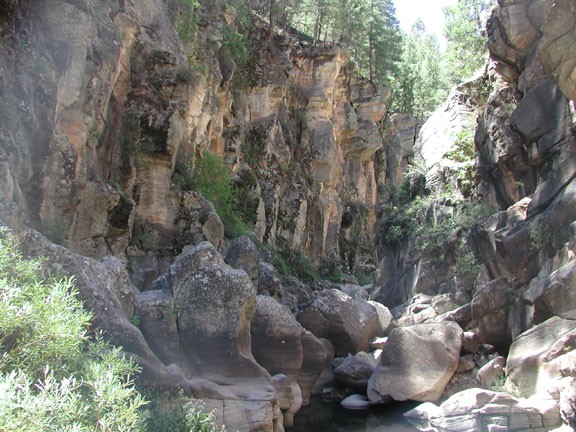
Although it's called Willow Valley, this area is a canyon. The walls are sheer and high and the distance between the walls are narrow. We prefer canyons anyway, they are so much more fun!
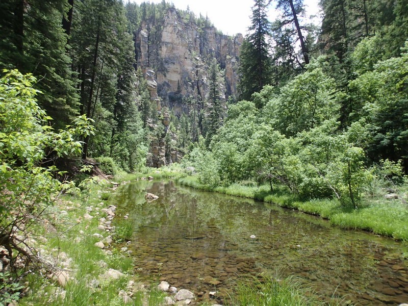
Very quickly, the first of several pools manifest themselves. There are scramble routes around the first two, but unless you are comfortable with climbing and exposure, I would recommend swimming through them. After all, the next pool is a mandatory swim anyway, so you're not going to escape getting wet. Make sure you only bring items in your back pack that can get wet (or are protected from water). The cold water makes for a refreshing change from the warm summer day.
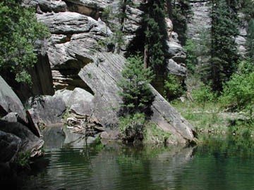
The dramatic scenery continues after these pools. There are no real trails here, although game trails show up once in a while. There are plenty of elk and deer in this canyon (how do they get in there?). We also saw Egrets, hawks, frogs, and plenty of lizards. The walking through this stretch of canyon is slow but very enjoyable. We spooked a trophy size buck in this canyon.
After 4.5 miles of hiking along (and occasionally through) the creek, you will reach the confluence of Willow Valley and Clover Creek. This confluence is unmistakable, and because the hiking is so slow along Willow Valley, you will want to fool yourself into thinking some of the other drainages are the confluence. This stretch of the canyon is well shaded with the canyon walls as well as hearty fir trees living along the bottom. The shade and constant water are welcome shields from the heat of the day.
After reaching the confluence, you will walk another 0.5 miles downstream to the Maxwell Trail. The trail winds up through the pine trees after a long straight section of Willow Valley, a few hundred yards before the canyon takes a sharp left turn. The trail is not easy to find, so keep a sharp eye out for the trail on your right as you walk downstream. Luckily, there will most likely be some other people at this point that hiked down the Maxwell Trail that can point you in the right direction. After walking up 0.6 miles and 700 ft on the Maxwell Trail, you arrive at the Maxwell Trail road. 1.5 miles of hiking along this flat road (after 0.9 miles, stay left at JCT_2L on the map) will take you back to where you parked your car.
