
- Hikes in Arizona
- Mogollon Rim
- Headwaters West Clear Creek
Headwaters West Clear Creek
Location
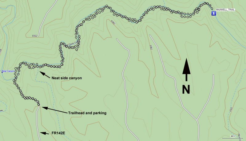
To get to the trailhead: from the Phoenix area, take HWY-87 North toward Payson. Go through the towns of Payson, Pine, and Strawberry while staying on HWY-87. About three miles past Strawberry is the junction of HWY-260 and HWY-87. Turn left onto HWY-260. After about 3.1 miles, turn right onto FR144 (just past mile marker 249). Drive 1.8 miles on FR144 to FR149. Turn left on FR149 and go 1.2 miles to FR142. Turn right on FR142 (it is a Y-intersection) and follow FR142 1 mile to FR142E. Make a left onto FR142E and follow it 2.7 miles to it's end and the start of our hike. The dirt roads are in pretty good shape. Although a high clearance vehicle is recommended, it probably isn't required.
Hike details
Season
- May
- June
- July
- January
- February
- December
Solitude
Difficulty
Permits
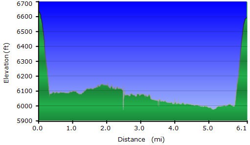
Hiking the Headwaters of West Clear creek, Arizona.
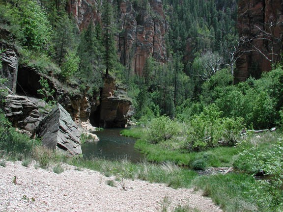
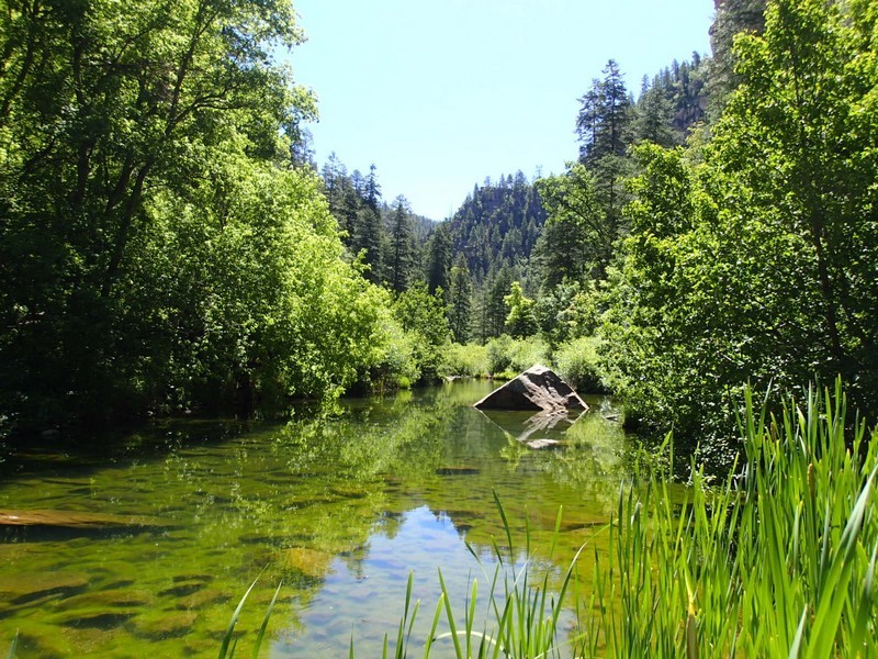
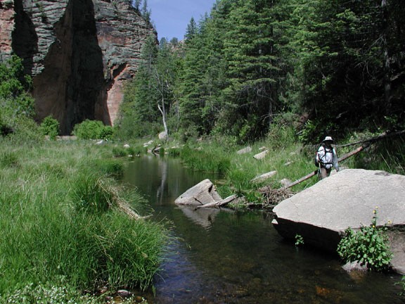
This hike starts at the south rim of West Clear Creek. This trail steeply descends (and I do mean steeply!) down 600 ft to the canyon floor. Expect some scrambling to get down this trail and watch your step. After reaching the canyon bottom, head upstream.
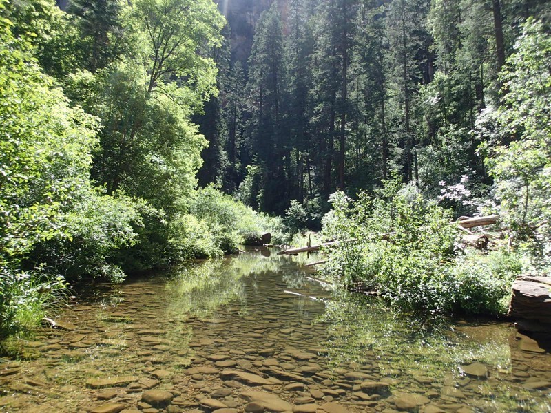
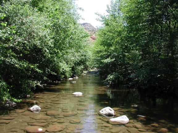
Progress is made up this canyon by following unmaintained trails created by hikers, wildlife, and fishermen, as well as by walking and wading through the creek. It's not likely you can keep your feet dry for this entire hike, so get 'em wet early and enjoy it.
There is a cool side canyon on your right as you hike up the canyon (about 0.3 miles). It doesn't go far back at all, so it's worth a look. A little farter (another 0.2 miles) is a spring that flows into the creek. I don't know if this is a seasonal spring, but it was pretty.
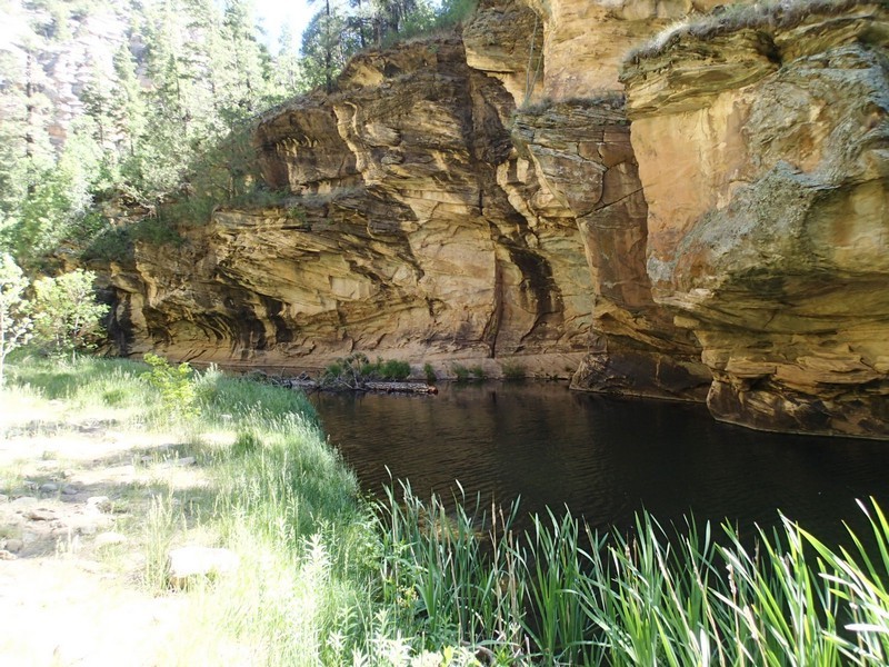
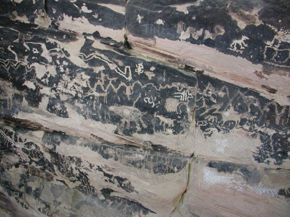
We set the destination of our hike as the Maxwell trail. After about 2 miles of hiking up the canyon, you pass Tramway Canyon (it enters on the left as you walk up the canyon). Get on the canyon left and hug the walls to see some pretty cool petroglyphs. I couldn't tell which were the real ones and which were copycat, but I found them interesting anyway.
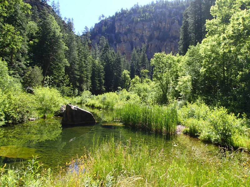
The Maxwell trail winds up through the pine trees on the left side of the creek (as you walk upstream). The trail is not easy to find, so keep a sharp eye out for the trail on your right as you walk downstream. Luckily, there will most likely be some other people at this point that hiked down the Maxwell Trail that can point you in the right direction. We found this a good point to turn around and find a nice secluded spot for lunch.
Lunch next to a running creek in a heavily forested canyon is always a treat. After a bite (and perhaps a nap!) return the way you came. Hopefully you remembered the creek area you came down so you can find your car again.