
- Hikes in Arizona
- Mogollon Rim
- Blodgett Basin and West Clear Creek
Blodgett Basin and West Clear Creek
Location
TO GET TO BULL PEN RANCH: Take FR618 for 2.2 mile and turn right on FR215 (Sign to Bull Pen Ranch). FR215 ends at the trailhead, which is 3.2 miles away. High clearance vehicles are recommended.
TO GET TO BLODGETT BASIN TRAIL: Take FR618 for 3.2 miles and turn right on FR214. Follow FR214 for 5 miles to the Blodgett basin trail turnoff. The road to the trailhead requires high clearance vehicles. After about 0.6 miles, the trailhead is marked by a group of Cairns (watch the road to your left and you will see it). The trailhead isn't too far from FR214, so if you want to hike from the road, that's OK too.
Hike details
Season
- April
- May
- September
- October
- January
- February
- December
Solitude
Difficulty
Permits
Hike up West Clear Creek via the Blodgett Basin trail in Arizona.
We took this hike under unique circumstances. During the summer of 2002, numerous forests were closed due to the danger of park users starting fires. As a result of these closures, the more popular route into West Clear Creek was closed (FR215 to Bull Pen Ranch). We chose the Blodgett Basin trail, which added an additional 3.4 miles and 1400 ft of elevation to our hike, however the reward was that we had the creek to ourselves. We didn't see anyone else all day. This is not normal for this area.
The Blodgett Basin Trail descends steadily down one of the side canyons into the West Clear Creek area. The trail is well marked and provides good views of the surrounding area. Admittedly, the main draw in this area is West Clear Creek, so if the normal route to the trail hadn't been closed, we would have missed the views of this hike.
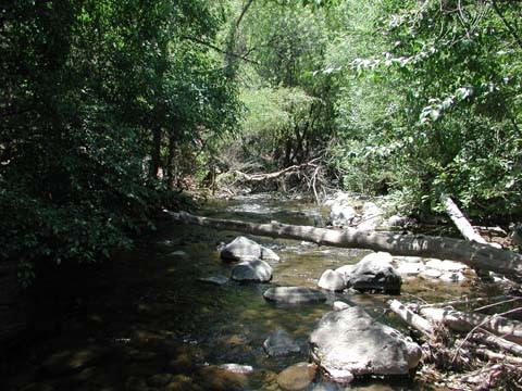
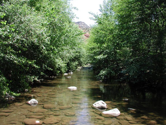
As the Blodgett Basin Trail nears the creek, notice where you are and watch the cairns carefully. It is difficult to find this trail again after you reach trail 17 (the trail that follows along side the creek). Trail 17 follows along the creek, but not as close as many of us would like. Sometimes the trail is on a bench above the creek and sometimes the trail crosses the creek. The temperature near the creek is easily 15 degrees cooler than the surrounding desert. There are plenty of side trails that lead from Trail 17 to the creek side, in case you are looking for some private swimming opportunities.
The area around the creek provides a very lush contrast to the surrounding desert scrub. Tall Sycamores, Cottonwoods, and other shade trees are abundant, and provide good shade. During high water, it might be difficult to cross the creek without getting wet.
After five miles of hiking along the creek, trail 17 turns up the canyon wall and 2 miles later reaches FR214A (after a 1800 ft climb). Of course, those of us that don't need a trail can continue up the canyon following the creek as long as you have the strength. There are some deep pools and wading and swimming would be required.
Take your time in this area and be sure to bring a swimsuit. There aren't many hikes in Arizona that have a combination of great hiking along with a cool, refreshing dip.