
- Hikes in Arizona
- Mogollon Rim
- Horton Springs
Horton Springs


Location
From the Phoenix area, take HWY 87 North towards Payson. Once in Payson, take HWY 260 east toward Kohl's Ranch, AZ. The left turn for the trailhead is a not so well marked road just after Kohl's Ranch (the sign is for the Tonto Creek Campground). Turn left here and take the road about 0.5 miles until you reach the Horton Picnic area. Park in the signed parking area if you can, otherwise park in one of the clearings along side the road. The trailhead starts at the camping area on the hill across the bridge from the parking area.
Hike details
Season
- June
- July
- August
- January
- February
- December
Solitude
Difficulty
This is a well marked trail. Kid approved.
Permits
Hike to Horton Springs on the Mogollon Rim in Arizona.
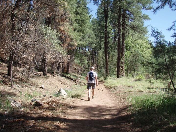
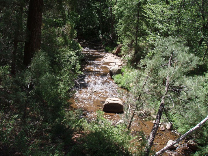
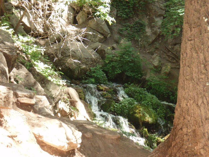
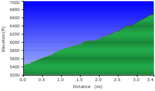
This is a great hike to escape the Phoenix heat in the summer. The trail runs through a pine forest and is easy to follow. To find the trailhead from the parking area, cross back across the small paved bridge and hike towards the campground. The signed trailhead will be on your left. For the first mile or so, the trail skirts a bubbling creek. There's a good climb toward the end of the hike, with a number of switchbacks that gains most of the hike's elevation. Eventually, you'll reach a signed trail that intersects with the Highline Trail. Turn right here (JCT 1R on the map) and hike the final few hundred yards to the spring. Fill up your water here and enjoy the day. Be sure to explore the spring area, as there's more than one spring. When ready, return the way you came.
