
- Hikes in Arizona
- Sedona
- Jack's canyon
Jack's canyon

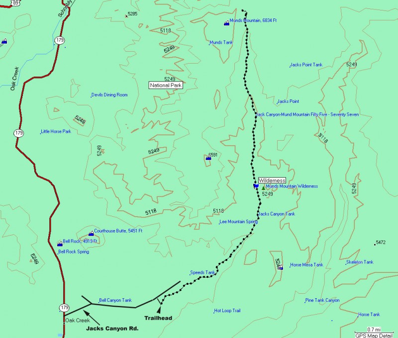

Location
From the Phoenix area, take I-17 North to HWY-179. Take HWY 179 towards the Village of Oak Creek towards Sedona. In the village of Oak Creek, turn right onto Jacks Canyon Road. Take this road 0.9 miles to a T intersection. Turn right here (also Jacks Canyon Road) and take this road 1.2 miles to the turn off for parking (on your right). Plenty of parking is available here, but no water or restrooms.
Hike details
Season
- March
- April
- May
- September
- October
- November
Solitude
Difficulty
Permits
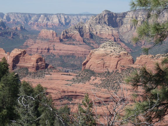
Hike up Jack's canyon near Sedona, Arizona.
Sedona has instituted a "Red Rock Pass", which is a fancy way of saying you need to pay to play. As of March, 2007, the fee is $5 per day per vehicle. There are plenty of places in and around Sedona to pay this fee and get the hanger, which you need to hang on your rear view mirror to keep from being towed.
No sugar coating here, this is a strenuous hike. Fourteen miles and 2000 ft of elevation gain will get your heart pumping and stretch those legs. Make sure you have enough water and snacks for the hike. I know I was pretty tired after this hike.
There are two hiking trails that depart from this trailhead. Make sure you take the Jacks Canyon trail and not the Hot Loop trail for this hike. For the first 1/3 of this hike, you will be walking through a burned area next to a road and a subdivision... not them most pleasant hiking. You could lose the trail here, but if you keep the road and subdivision on your left, you'll be OK. The hike bends around the subdivision, exits the burn area and starts the steady climb up Jacks Canyon.
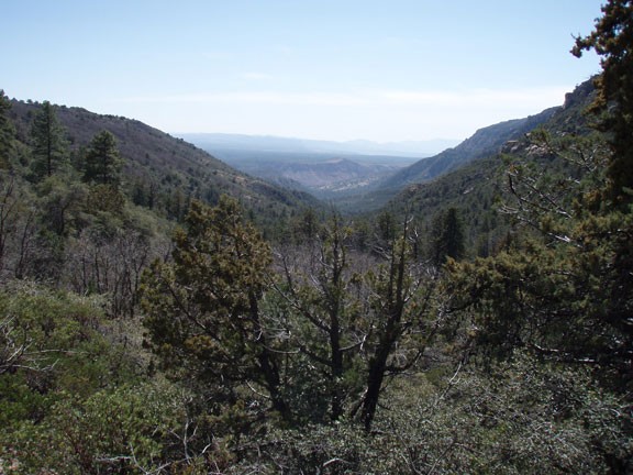
Thankfully, the vegetation returns after about 2 miles of hiking, providing some shade. The trail follows the usually dry wash in a steady climb. The next few miles can be draining due to the sandy trail and sporadic wash crossings. Route finding isn't too difficult here, just be sure to watch for the cairns when you cross the wash.
As you continue to gain elevation, the trail becomes a bit overgrown but the trees provide more shade. During this last stretch, the trail climbs more steeply as you walk through oak and pine trees to the saddle. After almost 2000 feet of total climbing, you will reach the saddle and a signed trail junction. To the left is the trail to the top of Munds mountain (500 more feet and 0.75 more miles). To the right is the Schnebly Hill trail, which ends up eventually at... Schnebly Hill Road. The views back down Jacks Canyon are impressive, but for the best views, you need to turn right at this trail junction onto the Schnebly Hill trail. Take this trail 0.25 miles to get unobstructed views of the red rocks of Sedona and Schnebly Hill Road winding up the side of the Mogollon Rim.
This is a nice spot for a break. When you're ready, return the way you came.
As I was returning, I passed some unhappy horses (with riders) that were really thirsty. Unfortunately for them, the trail was bone dry. Moral: Make sure you bring your water with you on this hike!
