
- Hikes in Arizona
- Sedona
- Casner Canyon
Casner Canyon


Location
From the Phoenix area, take I-17 North to HWY-179. Take HWY 179 past the Village of Oak Creek towards Sedona. At the intersection of HWY-179 and HWY-89A, turn right (North) onto HWY-89A. From this point, it is 2.9 miles to the parking pull-out. You will pass Grasshopper point and then mile marker 377. There are several unmarked pull-outs in this area. You are looking for the pullout on your right that has an unmarked gate. Parking is pretty limited, but the West side (left) has more parking than the East side. Please note: You will need a Red Rocks parking pass ($5) to park in this area.
Hike details
Season
- April
- May
- June
- September
- October
- November
Solitude
Difficulty
Permits
Hike up Casner Canyon near Sedona, Arizona
Sedona has instituted a "Red Rock Pass", which is a fancy way of saying you need to pay to play. As of March, 2016, the fee is $5 per day per vehicle. There are plenty of places in and around Sedona to pay this fee and get the receipt, which you need to put on your vehicle dash to keep from being towed.
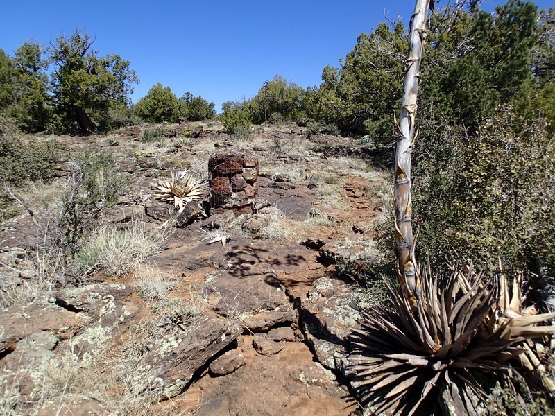
This hike requires some route finding at the beginning and and at the end. After parking at the unmarked pull-out, look at Oak Creek. If you look to your right, you will see an unmarked closed gate. Start walking on the good trail behind this gate, but be aware you won't be going very far on it. After about the first 20 steps, look left and see the signed trail headed down into Oak Creek Canyon. Take this trail down towards the creek. At the bottom of this trail you should see a metal sign for Casper Canyon Trail.
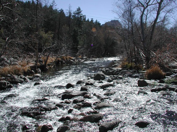
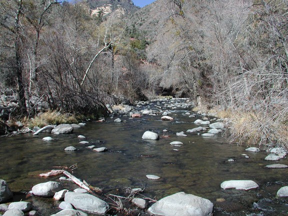
Head towards the creek from the sign. Once you reach the creek, you can look across and see the mouth of Casner Canyon. The trail heads up this canyon. Unfortunately, this is not the best place to cross Oak Creek if you want to keep your feet dry. Go upstream a bit to find a better place to cross. Once across, head back downstream to the mouth of the canyon. It may take a bit of looking to find the well marked trail up the canyon on your right (while looking up Casner canyon).
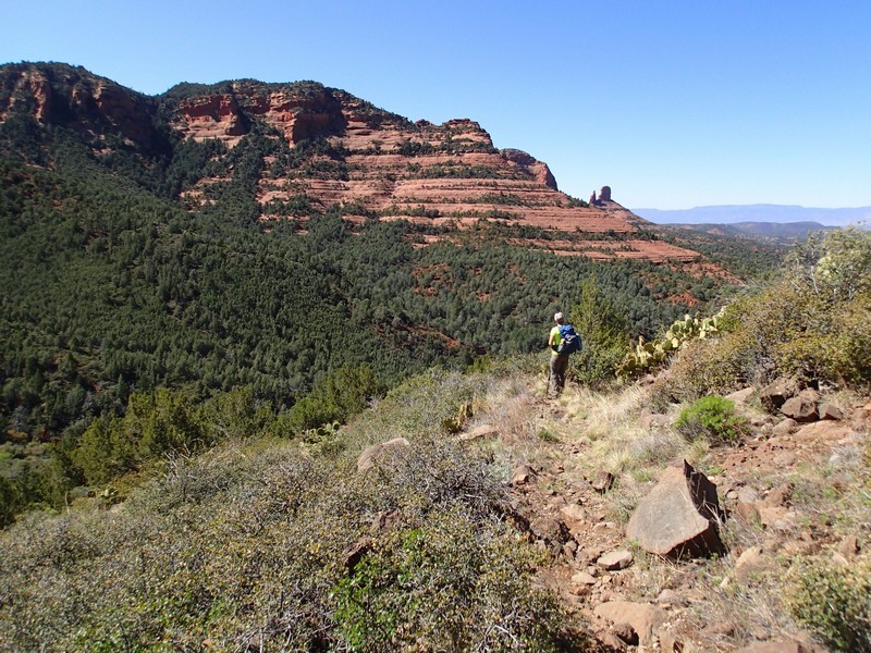
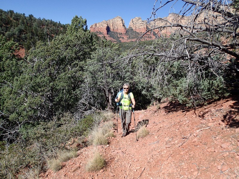
Once you find the trail, you can rest your route finding skills for a while and enjoy the steady climb and easy to follow trail towards the eastern rim of Oak Creek canyon. Be sure to stop and look behind you once in a while to enjoy the rapidly appearing views of Sedona and the surrounding red rocks. The solitude on this trail comes at a small price, as parts of the trail are somewhat overgrown. I was thankful that I was wearing a long sleeved shirt and pants for this hike.
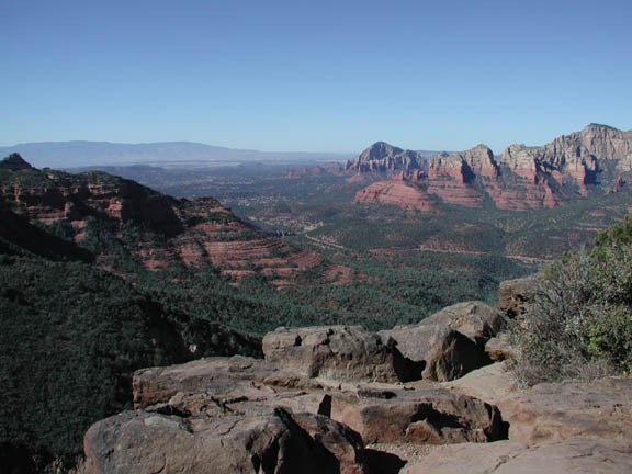
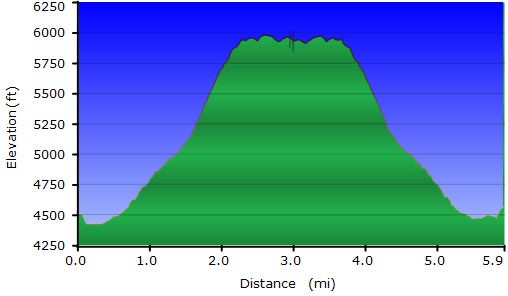
After about 1.8 miles of hiking and 1500 ft of elevation gain, the trail flattens out as you reach the top of the eastern rim of Oak Creek Canyon. The views are hidden at this point, so we continue to follow the trail to the right (South) towards the Schnebly Hill Vista. Bring out your route finding skills again, as it is about 1.2 more miles to the vista. The trail starts out strong, but becomes more faint the closer you get to the vista. They've done a pretty good job adding cairns to the trail to keep you headed in the correct direction. Hopefully your route findings skills carry you through to the impressive views at the vista.
Unfortunately, you have to share the views with the lazy car people that drove up Schnebly Hill Road. There are plenty of nice and private places along the rim to sit down, enjoy the views, and have a snack.
When you're ready, return the way you came.
