
- Hikes in Arizona
- Sedona
- Woods Canyon
Woods Canyon


Location
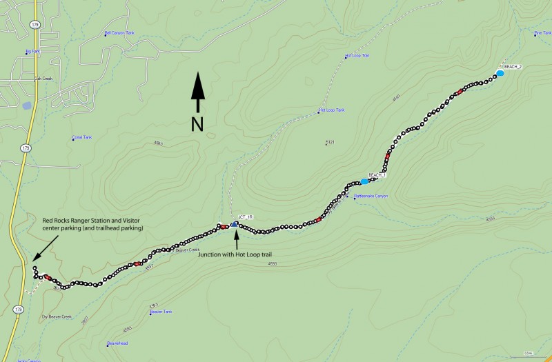
From the Phoenix area, take I-17 North to exit 298 to HWY 179 West towards the Village of Oak Creek. About 5.5 miles on HWY 179 gets you to mile marker 304. At about mile 304.7, turn into the signed Red Rocks ranger station and visitor center. There are three parking lots here. Park on the second parking area on your right (not the parking area for the visitor center at the end... that's too far). The signed trailhead for Woods Canyon is on the far right side of this middle parking area (it's kind of a small trailhead sign, so it may be a bit tricky to find).
Hike details
Season
- March
- April
- May
- October
- November
Solitude
Difficulty
Permits
Hike up Woods Canyon near Sedona, Arizona
While many hiking trails in Sedona require a "Red Rock Pass", as of April 2016, this trailhead is not one of them.
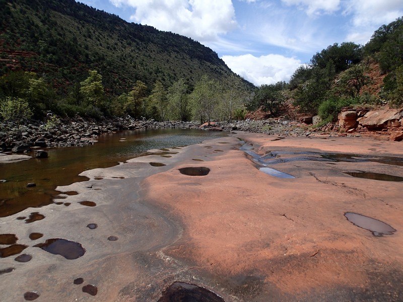
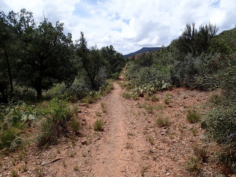
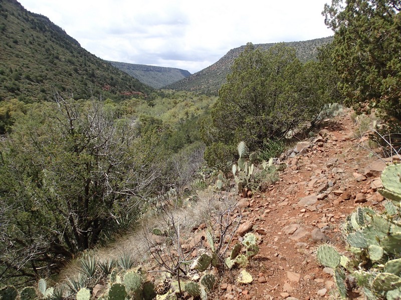
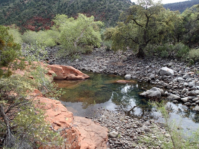
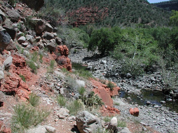
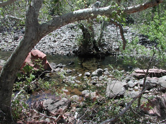
The trail is well marked throughout this hike. After walking briefly through a pretty riparian area, the first 1.25 miles of this hike travels through a flat and open area until you reach the wilderness boundary. After passing into the wilderness, the trail quickly assumes a different personality, as many water loving shade trees (oak, sycamore) show up. There were many Javelina tracks, although we didn't see any. After another mile of hiking, the hot loop trail takes off to the left (ending up on top of Horse Mesa, JCT_1R on the map). Stay right to stay on the Woods Canyon trail. The trail stays on the left side and just above the creek. After about 3.5 miles of total hiking, you'll reach a very scenic red rock beach (Beach #1 on the map). For a short day hike, this would be a nice spot to turn around. We continued hiking to five miles in where we found an even more impressive red rock beach (Beach #2 on the map). This beach reminded us a great deal of Slide Rock, but without the crowds of people! We found a nice place on the red rock beach next to the water for lunch.
Water is seasonal in Dry Beaver Creek. In the spring, the snowmelt provides the highest water levels and in the summer, it reverts to a mostly dry wash. So the best time to do this hike is in the Spring.
After lunch and a break, return the way you came. Enjoy!
