
- Hikes in Arizona
- Sedona
- Boynton Canyon
Boynton Canyon


Location
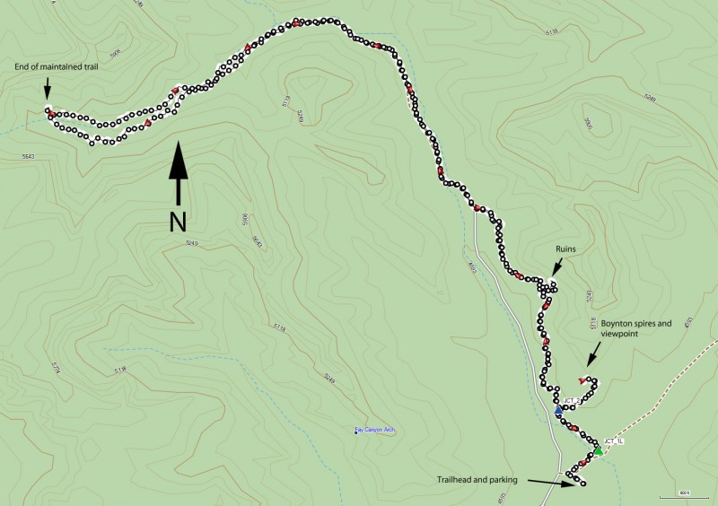
To get to the trailhead: from the Phoenix area, take I-17 North toward Flagstaff. Just after Verde Junction, take HWY-179 west towards Sedona. Once in Sedona, take HWY-89A South. After 3.1 miles, turn right onto Dry Creek Road. After 3 miles, turn left onto Boyton Pass road. Turn left and go 2 more miles to T intersection. Turn right and go a few hundred yards, turning right into the signed Boynton Canyon Trailhead. Parking is limited. You will need a Red Rock Pass to park at this trailhead ($5 per car as of October 2016).
Hike details
Season
- April
- May
- October
- November
Solitude
Difficulty
Permits
Hike through Boynton Canyon, Sedona, Arizona
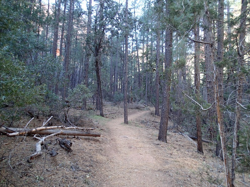
This hike starts just outside the Enchantment Resort. The trail winds around the perimeter of the resort (wave to the rich people) then quickly leaves civilization behind as it heads up the canyon. This hike is mostly level, making it a good choice for bringing your cousins from Chicago on their very first Arizona hike without killing them.
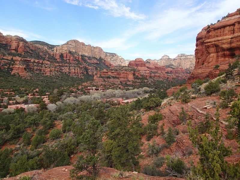
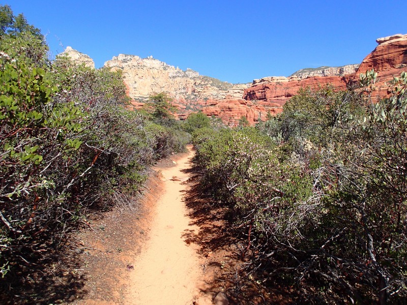
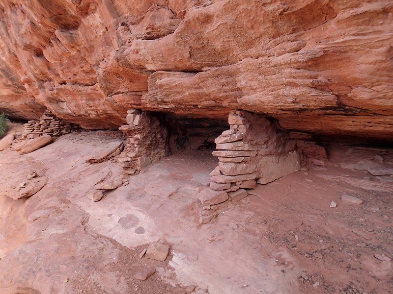
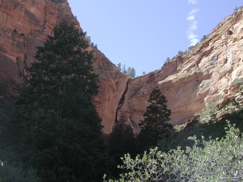
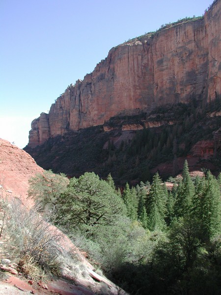
The start of the hike follows dry hills with little shade, but quickly changes into forest hiking through evergreens and pines. At the first signed trail junction (JCT_1L on the map) stay left here. Soon there is a signed spur trail (JCT_2 on the map) if you're interested in a short hike to some good views... oh, and the "Boynton Canyon vortex spires". I'd recommend it, as the views of the area are nice. Back on the trail, and continue up canyon. Near the domed "Sultan's House" at the enchantment resort there is another spur trail (actually more of a scramble route) to some ruins. I'm not sure how legitimate the ruins are, but they are fun to check out. Keep an eye out to your right from the trail as you can see them in an alcove. Look for cairns to see the route. This spur trail requires scrambling, so don't climb up anything you don't feel comfortable climbing down. After checking out the ruins, backtrack to the main trail. Further into the canyon, the walls begin to surround you, rising 800 ft above the trail on both sides. Eventually, all hikes come to an end, and this one does as well. There is a sign instructing hikers not to continue to save the fragile environment. In this area, there is also a 'Vortex' site (near the beginning of the trail, forking off to the right). What is a 'Vortex' site you ask. New Age people believe that it is a 'concentration of electromagnetic energy'. As far as I'm concerned, it's just a nice place to have lunch.
