
- Hikes in Arizona
- Sedona
- Wilson Mountain North
Wilson Mountain North


Location
Hike details
Season
- May
- June
- July
- August
- September
- January
- February
- December
Solitude
Difficulty
Permits
Hike up Wilson Mountain near Sedona and Oak Creek Canyon, Arizona
Sedona has recently instituted a "Red Rock Pass", which is a fancy way of saying you need to pay to play. As of May, 2013, the fee is $5 per day per vehicle. There are plenty of places in and around Sedona to pay this fee and get the receipt, which you need to put on your vehicle rear view mirror to keep from being towed.
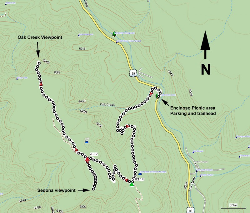
There's actually two routes to get to the top of Wilson Mountain. This hike details the Northern most route, which is a better choice in the summer months. There is more shade on this trail than the alternate and is a bit shorter.
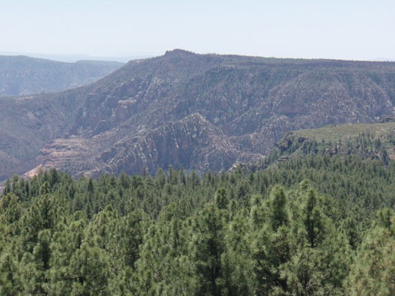
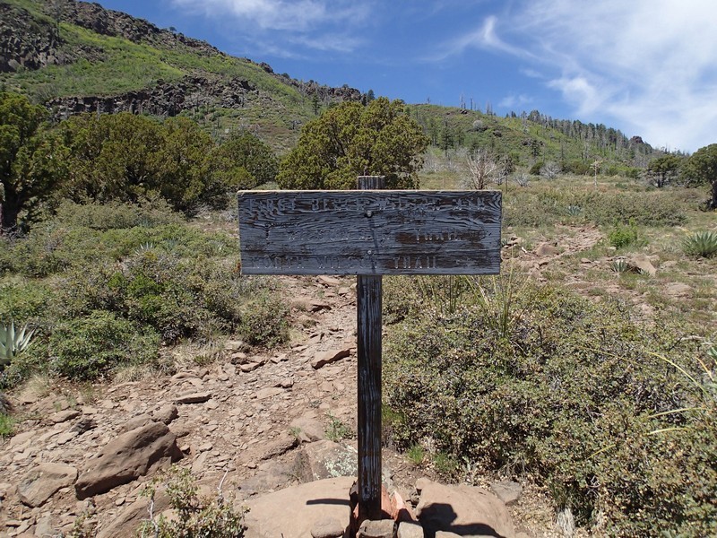
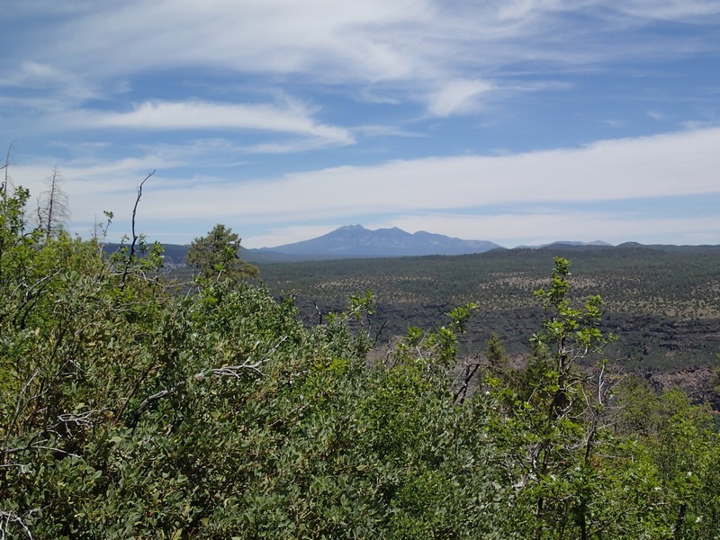
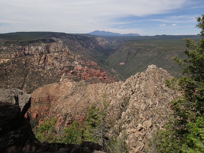
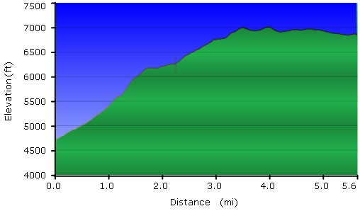
After walking up the first 1.5 miles and numerous switchbacks, you get a nice view of Oak Creek canyon and the parking area. Walk along the rim another 0.7 miles to a signed trail junction. Take a right at the trail junction (JCT 1R on the map) to stay on the Wilson Mountain trail (the left fork follows the Southern route) and continue another 0.7 miles up more switchbacks. At the top, there's another signed trail fork (JCT 2 on the map). The left fork goes 0.4 miles to a great view of the Sedona area. The right fork goes 1.5 miles to a great view of the Oak Creek Canyon. You win either way. I recommend doing them both, after all, you've already paid the price in elevation, you might as well enjoy the rewards of your hard work.
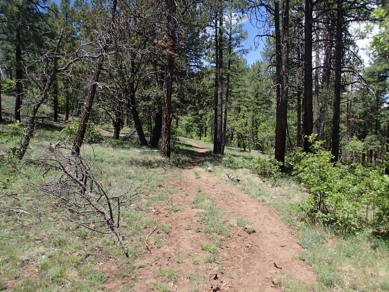
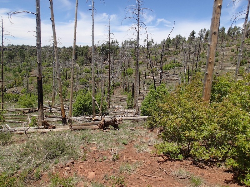
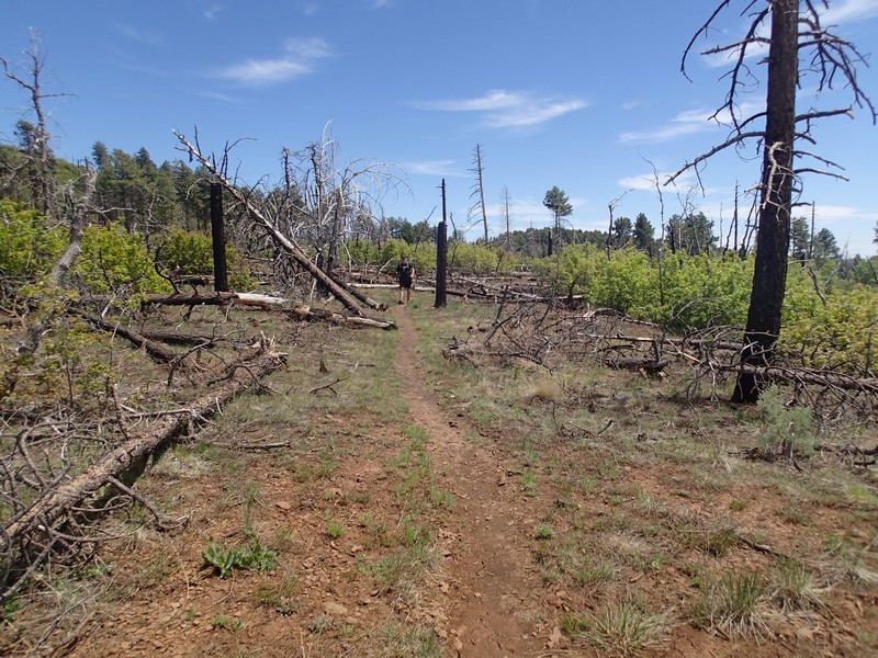
The top of Wilson Mountain used to be heavily forested and this section of the trail would be an explosion of color in the fall. Unfortunately, the Brins fire of 2006 destroyed much of the beauty of this area. As a result, the 0.7 mile section of the trail from the first bench to the second bench is overgrown and brushy with some pricker bushes. Long pants are recommended on this hike for this reason. Additionally, on the top of Wilson Mountain, there are downed trees blocking sections of the trail, especially on the beginning of the spur trail to the Sedona viewpoint. It is easy to lose the trail in this section, so use those route finding skills.
You gain a good bit of elevation on this hike. If you see black clouds roll in or hear thunder or see lightning, head back down.
This is a long hike, so bring plenty of food and water.
