
- Hikes in Arizona
- Sedona
- Bear Sign Trail and Dry Creek Trail
Bear Sign Trail and Dry Creek Trail


Location
From the Sedona area, take HWY 89 about 3 miles after the junction of HWY 179 and HWY 89 in Sedona. Turn right on Dry Creek Road and go 2 miles to the dirt road of Dry Creek Road. After about 4.4 miles on a rough road (high clearance vehicle required!), park at the trailhead.
Hike details
Season
- April
- May
- June
- September
- October
Solitude
Difficulty
Permits
Hike descriptions of both the Bear Sign canyon trail and the Dry Creek trail in Sedona, Arizona.
The last 4.4 miles of Dry Creek road has deteriorated significantly since the last time I was on it. The wonderful hiking books by Cosmic Ray would say that this was a "rough road, but cars are OK if you go slow". No longer. The road is now only suitable for high clearance vehicles. Although the reward for navigating to the end of this rough road are several secluded hiking opportunities.
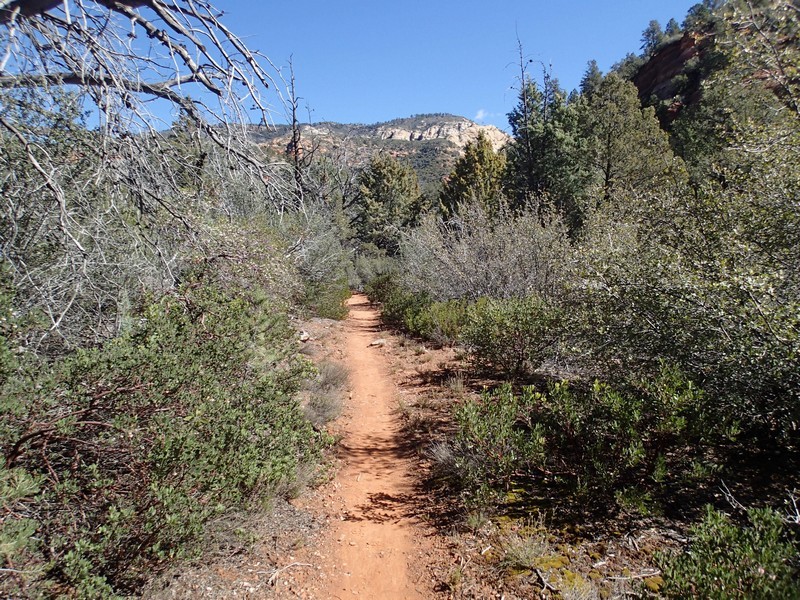
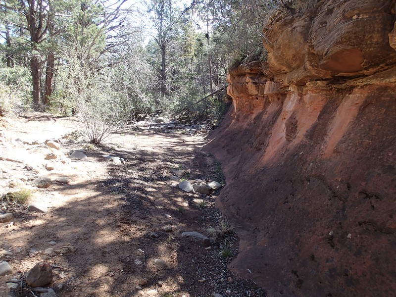
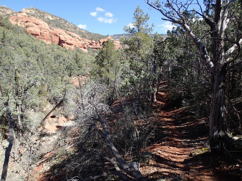
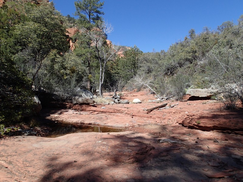
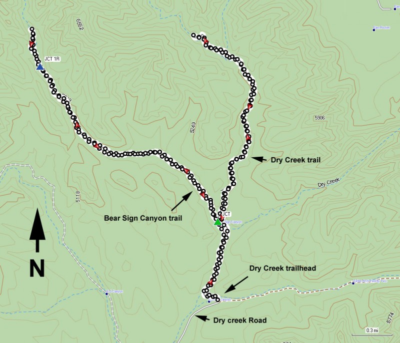
To hike the Dry Creek or Bear Sign Canyon trails, take the signed trail at the west side of the parking area. After about 0.5 miles from the parking area, the trail splits at a signed trail junction (JCT on the map) and follows two different canyons. If you go left, you will walk down Bear Sign Trail. If you go right, you will walk down Dry Creek Trail. Either route is rewarding. High cliff walls and solitude abound. If you have the time or the inclination, take both routes like we did. The turn around points going up either canyon are arbitrary. We turned around in each canyon when the trail started to get overgrown. On the Bear Sign canyon trail this was shortly after the signed trail junction with the David Miller trail, which heads west over to HS canyon nearby. On the Dry Creek trail it was after the canyon starts to get heavily forested.
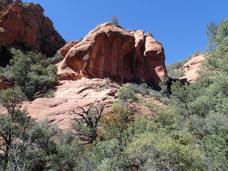
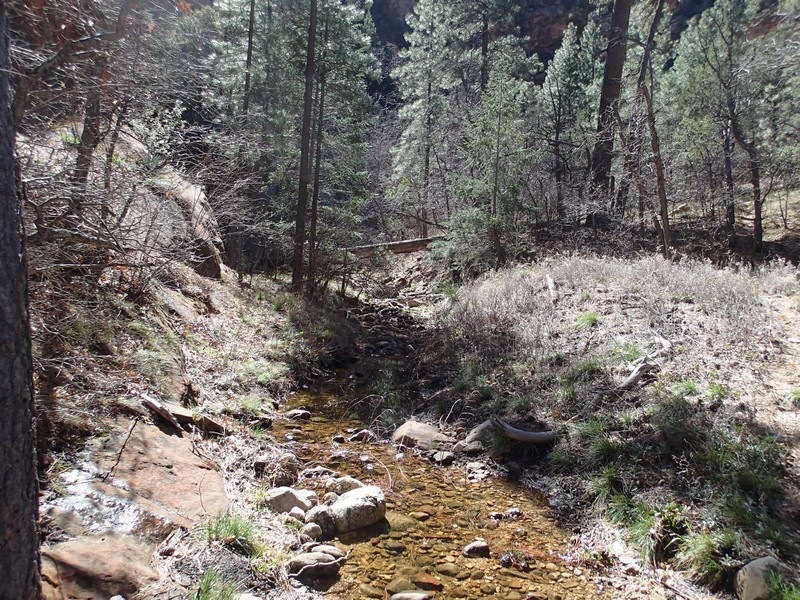
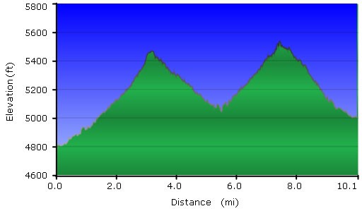
Bear Sign Canyon is more forested and enclosed, with a clear trail. Dry creek canyon is more open, with good views of the red rocks towering above. We hiked a total of 10 miles to head up both canyons until we turned around and would recommend the same. Enjoy!
Note: he Vultee Arch trailhead is also at this parking area (about 1.6 miles and 500 feet up from the parking area to the arch).
