
- Hikes in Arizona
- Sedona
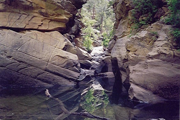
- Pumphouse Wash
Pumphouse Wash

Location
From the Sedona area, take HWY 89A towards Flagstaff and up the Oak Creek Canyon. 14 miles from Sedona is the downstream entrance to Pumphouse wash (near milepost 387, just before the bridge). If you continue up HWY 89A to milepost 391.5, you can turn right onto FR237 and drive 1.5 miles to an upstream entrance to Pumphouse wash. We started from the bottom and hiked up.
Hike details
Season
- June
- July
- August
- September
Solitude
Difficulty
Permits
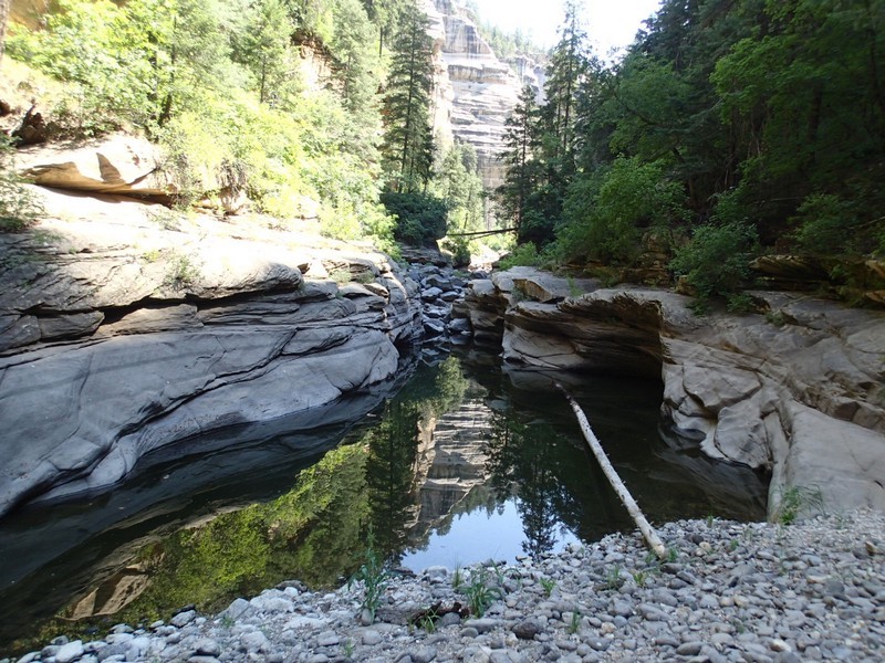
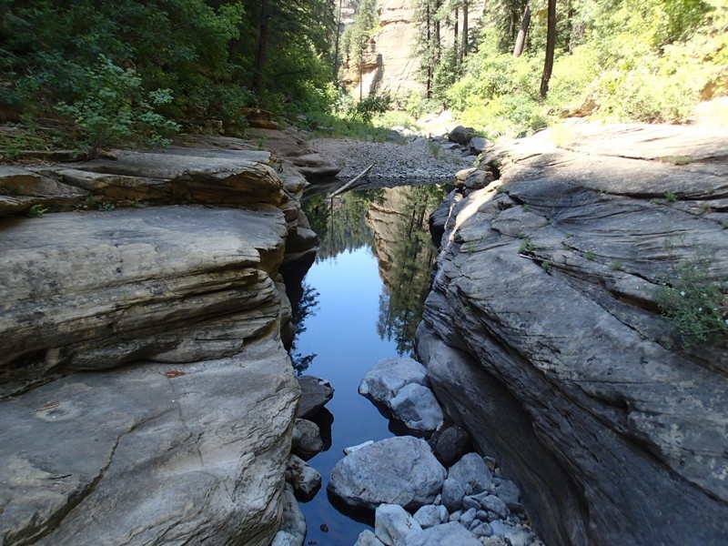
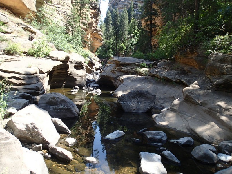
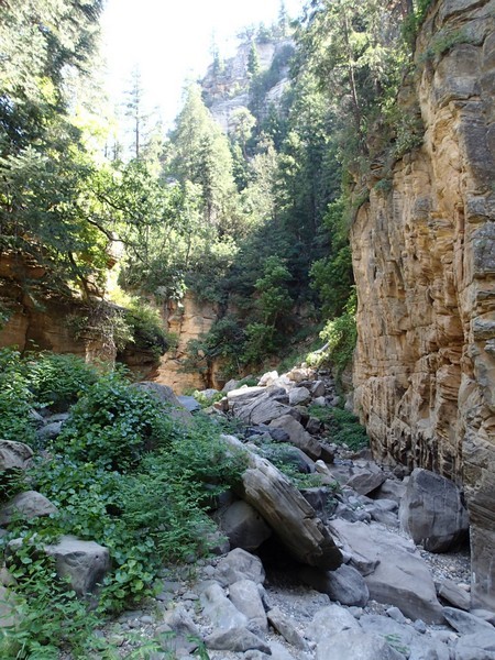
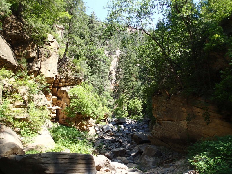
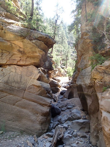
Hike through Pumphouse wash near Sedona, Arizona.
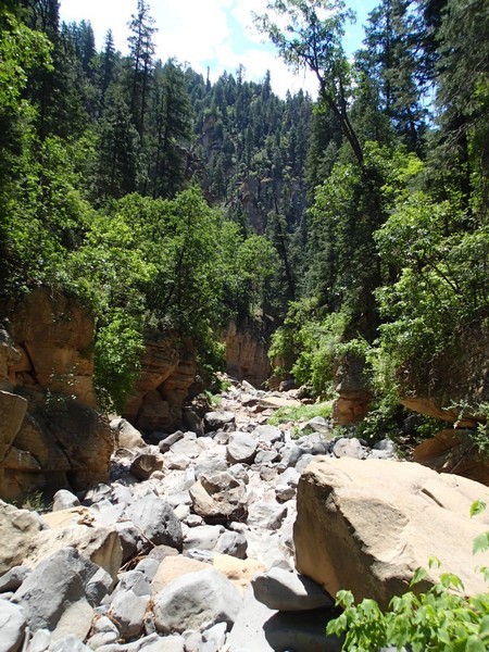
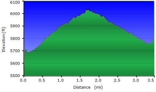
First step is to make your way to the bottom of the canyon. If you parked south of the bridge, there is a good route down on the left side of the bridge. This is a good canyon hike in the summer months. You'll be walking on boulders for the duration of this hike. Don't be frustrated on the slow progress due to the boulders and route finding, enjoy it. There's occasional pools to cool off in or scramble around. You can go as far as you want and turn around. We hiked in for about 1.5 hours until we came to some very scenic narrows. To continue would have required a long swim through some water or an unknown walk around. We chose lunch and to turn around.
In some parts of this canyon, the walls surrounding you are 1000 feet high. Scrambling around and over boulders is fun!
