Ready for a hike?  We've got hundreds of well documented Arizona hikes.
This is the source for everything you need to know about Arizona Hiking.

Main menu

Cart Empty

You are here: ArizonaHiking.org

Doe Mountain

Updated
Doe Mountain
Doe mountain views
Doe Mountain views
On the top of Doe mountain
Bear mountain (as seen from Doe Mountain trail)
On the Doe mountain trail
Map: Doe mountain
Elevation plot: Doe mountain
Doe Mountain

Location

How to Get There
This hike is located near Sedona, AZ.

From the Phoenix area, take I-17 North to exit 298 to HWY 179 West into Sedona. Follow the signs to 89A West. Turn right 3.1 miles after the junction on Dry Creek Road. When you reach the intersection of 152C, turn left and go another 1.6 miles. At Boynton Pass road, turn left and go the final 1.2 miles to a well signed parking area on the left. There is a restroom here but no water.
addressone
Boynton pass road
city
sedona
state
az
Region
Sedona

Hike details

Distance
1.50 [Miles] Total
Hike Distance- Details
1.5 miles round trip.
Time
1.00 [Hours]
Time-details
It took us an hour with a 20 minute stop at the top for exploring and lunch.
Elevation Change
450 Total gain/loss [Feet]
Elevation Details
about 450 ft quick ascent to the top
Hike Trail Type
Out and Back

Season

Best Season
  • April
  • May
  • October
  • November

Solitude

Solitude
Low
Solitude Details
This is a popular hike. You'll be rubbing elbows with your fellow hikers if you come here on a weekend. Once at the top, you can find a semi-secluded place along the rim. Expect to meet 15-30 people on this hike during a weekend.

Difficulty

Difficulty Rating
Easy
difficulty detail
Quick climb with some views at the top. This is an Easy hike. The climb will get your heart going, but it's over much too quickly. The hike is kind of short.

Permits

Permit Info
Red Rocks pass ($5 per vehicle as of May 2016)
Be Aware of
Fee to park

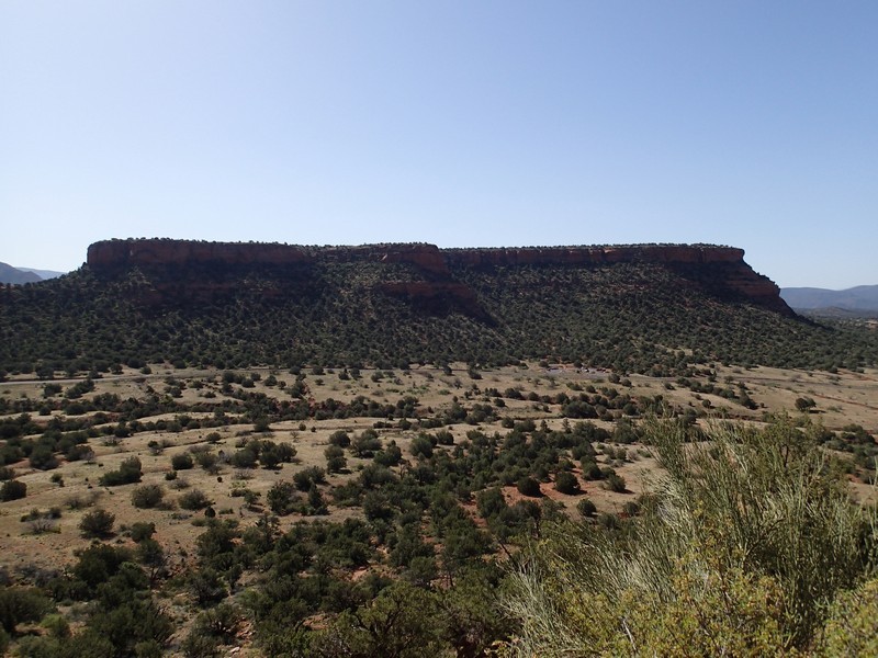
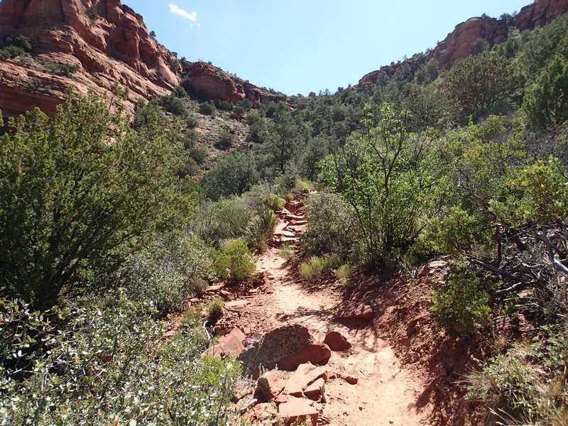
hike up Doe Mountain near Sedona, Arizona

Sedona has recently instituted a "Red Rock Pass", which is a fancy way of saying you need to pay to play. As of May, 2016, the fee is $5 per day per vehicle. There are plenty of places in and around Sedona to pay this fee and get the receipt, which you need to put on your vehicle dash to keep from being towed.

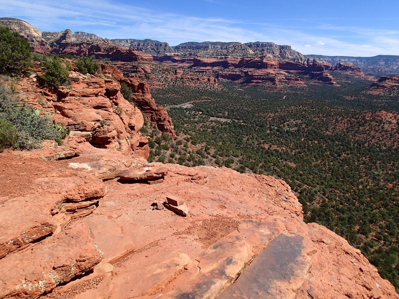
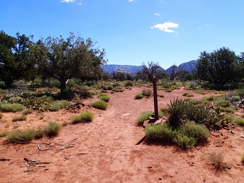
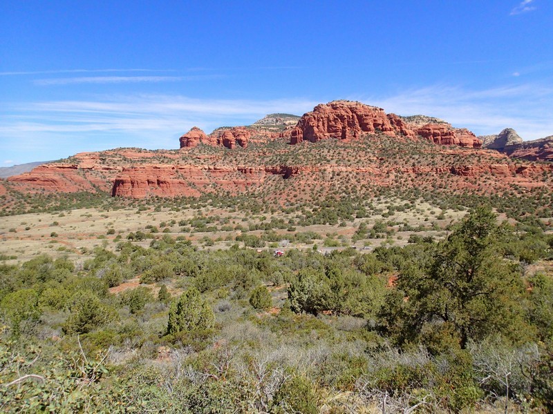
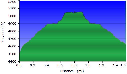
From the parking area, head up the clearly signed and easy to follow trail. At the signed intersection with the Aerie trail (JCT_1RL on the map), take a right then a quick left to stay on the Doe Mountain trail. This hike is a too quick climb to some good views of Sedona and the surrounding mountains and landmarks. To lengthen the hike, we hiked around the edge of this plateau. There are a number of good places for lunch and views.

After this hike, you'll most likely be looking for another one in the area... I know we were.

Map

Swap Start/End
Adding markers to the map ...
Facebook