
- Hikes in Arizona
- Superstition and Mazatzal Wilderness
- Massacre Grounds and Massacre falls
Massacre Grounds and Massacre falls

Location
To get to the trailhead: From the Phoenix area, take US-60 East to the Idaho Road exit, turn left (North) on this exit. After Main Street, take HWY-88 which forks off to the right towards the lakes. After about 5 miles you will pass the Lost Dutchman State Park on the right side of the road. An additional 0.2 miles will get you to the First Water trailhead turnoff (FR78). Drive 0.5 miles on this well graded dirt road. The signed trailhead for the Crosscut trail is on your right. Park here, as this is also the trailhead for the Massacre grounds trail. The old trail access on FR28 has been permanently closed and the road no longer exists.
Hike details
- Water
- Wild Flowers
Season
- January
- February
- March
- April
- October
- November
- December
Solitude
Difficulty
Permits
Hike to the Massacre grounds and Massacre falls in Superstition Wilderness in Arizona.
UPDATE: The trailhead of this hike has changed. The road that used to lead to the trailhead has been closed and bulldozed over. I'm not entirely sure why, but it could be related to the huge "No target shooting!" sign that replaced the road, along with the spent shotgun cartridges I found near the old trailhead start.
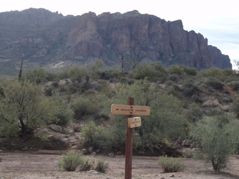
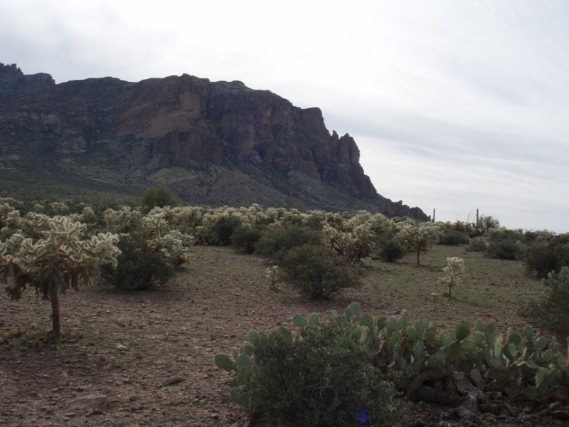
This is a nice introductory hike to the Superstition mountain wilderness area. After parking at the Crosscut trailhead, head through the break in the fence towards the sign. There are two signed trailheads here. The Crosscut trail is on the right, while the Massacre grounds trail starts at the left. Head left of the parking area. This trail cuts through the desert, filled with all of our favorite cacti (Saguaro, prickly pear, cholla). The trail is easy to follow and well cairned. After 0.8 miles of hiking, you'll reach a break in a fence (labeled on the map). This was the old parking area for the start of the trail. Head through the fence here.
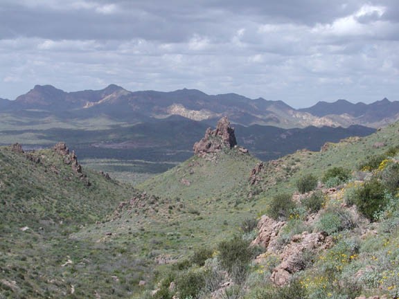
The destination of this hike is the location of a rumored ambush of Spanish miners by Apache Indians. The real attraction in this area is the desert itself, especially after a rain. The trail climbs gradually and is not very strenuous. As you climb, be sure to stop and look around once in a while to enjoy the unfolding views.
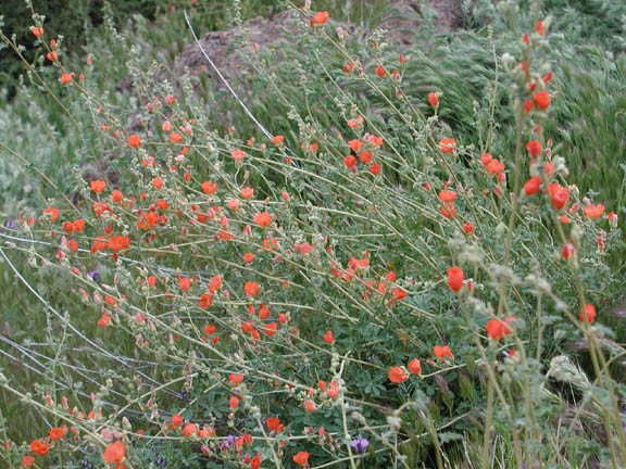
After a rain this area explodes in colors. Red, yellow, purple, and orange wildflowers cover the mountainsides, giving an entirely different perspective on the desert.
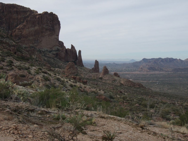
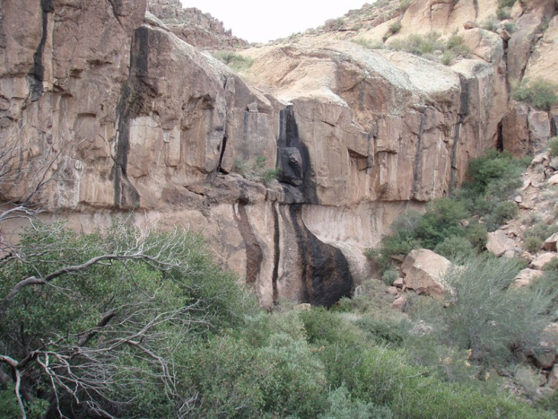
There is some light route finding involved, as once in a while a faint spur trail may tail off from the main trail. Many of these spur trails end up back on the main trail, but you should try to follow the most well worn path. At some points in the trail, keep your eyes out for cairns to stay on trail. Eventually, you will reach a trail junction (JCT on the map). If you go left, you will quickly end at a nice lookout. This would be a good enough place to have a snack and turn around. If you would like some additional hiking, take the right fork. This trail leads to a seasonal waterfall that is being locally called "Massacre Falls". When I did this hike in late December, it was after some rains, so this waterfall was gently flowing. The trail gets more overgrown the closer you get to the falls, but it is still well worth the extra effort, especially if there have been recent rains.
When you are finished enjoying the views and the flowers, return the way you came.
