
- Hikes in Arizona
- Northern Arizona
- Dry Lake hills
Dry Lake hills

Location
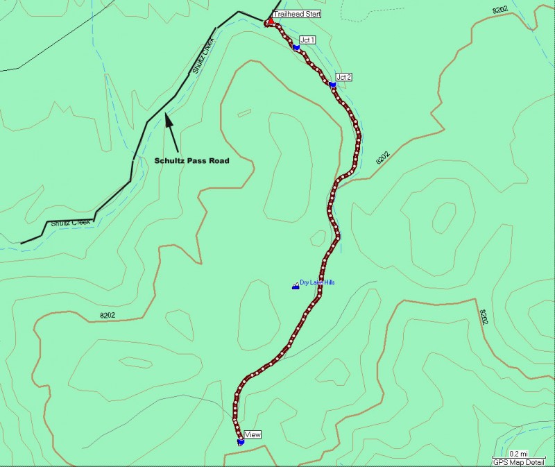
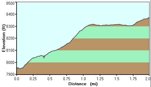
From the Flagstaff area, take HWY-180 towards the Grand Canyon. About 2 miles out of Flagstaff, turn right onto the signed Schultz Pass Road. After 0.3 miles, this road makes a sharp left turn (going straight will put you on the Elden Lookout Road). Continue on this well graded dirt road for 4.1 miles (4.4 miles total from HWY-180). You will have reached the trailhead when you see a prominent gate in the valley to your right. There is not much parking here, but there is a small pullout on your right very near the gate.
Hike details
Season
- May
- June
- July
- August
- September
- October
Solitude
Difficulty
Permits
Hike the Dry lake hills trail near Flagstaff, Arizona.
After finding some parking on the narrow Schultz Pass road, head through the iron gate and follow the signs pointing towards the Sunset trail (Schultz Loop). It should be the trail heading into the forest, not the one that runs along side the road (that trail is Schultz Creek Trail).
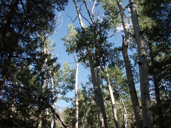
The trail is wide, as it is a former forest road now closed. It is easy to follow, but keep in mind this area is justifiably popular with mountain bikers, so be aware. Very soon after starting, there is a faint trail leading off to the right (Jct 1 on the map). Stay left here. You'll start to gain some elevation as you head closer to the Dry Lake Hills. This area of the forest is shaded by Aspen and pine so it is a pleasant walk even in warmer temperatures.
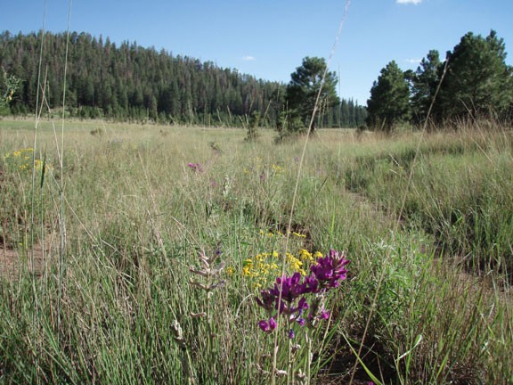
After about a mile of hiking, you will reach the easily recognized Dry Lake Hills area. This section resembles a wide open meadow which contains seasonal water. Marked Jct 2 on your map, stay left here to travel further into the Dry Lake Hills. There are numerous wildflowers to enjoy as you continue along the two track trail.
Pretty soon, the track splits. The path to the left (as described by this hike) heads to a distant view of Flagstaff and Mount Elden. The view has some nice sitting rocks and is a good place to take a break and relax.
If you still have energy, feel free to back track to the right fork, which continues through the meadow a bit. Turn around when you like. Enjoy!
