
- Hikes in Arizona
- Northern Arizona
- Davenport Hill
Davenport Hill


Location
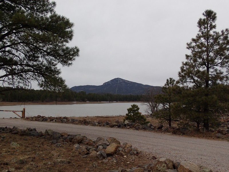
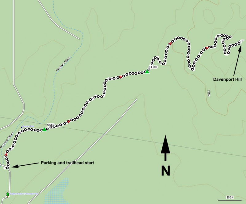
To get to the trailhead: from the Flagstaff area, take I-40 West out of town towards Williams, Arizona. Exit I-40 at At exit 165 and drive through the town of Williams on the main road (Railroad Avenue). On 4th Street, turn left (South). This road will turn into Perkinsville Road (HWY 73). After 3.8 miles on this road, follow the sign towards Dogtown lake by turning left (East) onto FR140. After 2.8 miles on FR140, turn left onto FR132 and take the 1 mile to the parking near the boat ramp.
Hike details
Season
- May
- June
- July
- August
- September
- October
Solitude
Difficulty
Hike up Davenport Hill near Kingman, Arizona
This hike may be more popular in the summer, but when we did it in early October, we had this hike mostly to ourselves. We had intended to start at the boat ramp to Dogtown lake, but the campground (and the road to it) had just closed. So we hiked the extra 1 mile to the start of the trail.
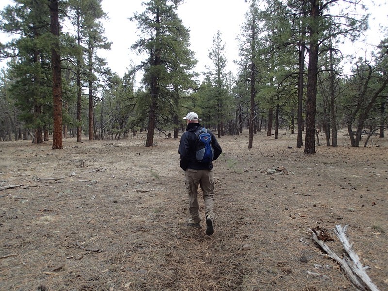
The well marked trailhead starts from the parking area next to the boat ramp. The first part of this trail is a nature walk, complete with markers of interesting flora. While this hike starts on this nature walk, after about 0.25 miles you will see a small sign pointing you towards the top of Davenport Hill. The trail walks through a forest of pine, oak, and spruce as it gradually climbs towards the hill. After about 0.4 miles of hiking, you'll reach a small gate. Please close it behind you.
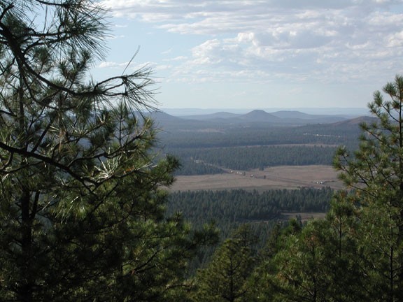
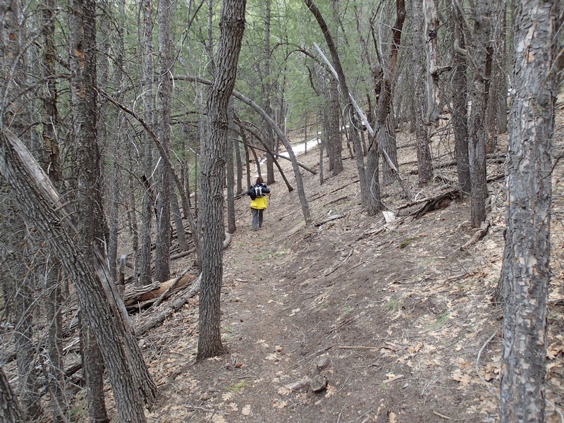
After about 1.3 mile of hiking, you cross a dirt road. From here, the trail begins to climb in earnest to the summit. The trail winds around the hill, presenting different viewpoints of the surrounding area. The forest is still thick along this trail, so enjoy the views when they present themselves.
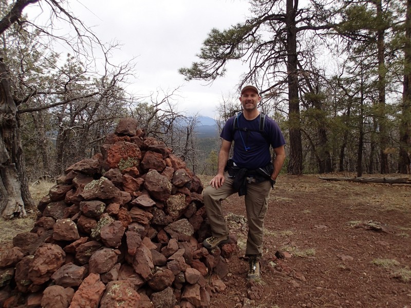
After 2.75 miles of hiking, you reach the top, which is marked by a sign "Davenport Hill, Elevation 7805". The forest hides most of the views here, so this is mainly a good spot for lunch and your turnaround point.
