
- Hikes in Arizona
- Northern Arizona
- Dorsey Spring
Dorsey Spring
Location
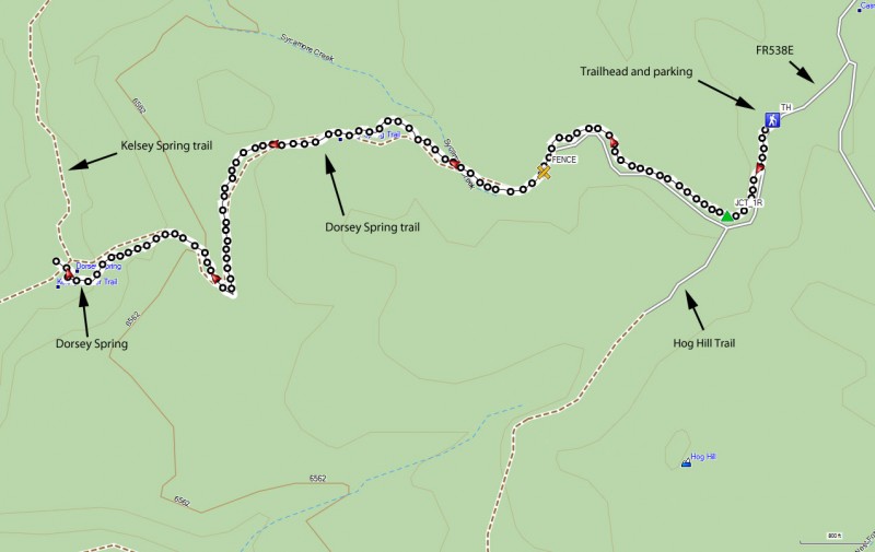
To get to the trailhead: from the Flagstaff area, take HWY-66 West out of town, turning South (left) onto Woody Mt Road (FR231). This road starts off as paved. Soon after it passes over I-40, the road turns into good graded dirt. Follow this road 14 miles to FR538. Make a right turn onto FR538 and take it 5.7 miles to FR538E. At this point, the road turns a bit nasty... high clearance vehicles recommended. Turn right on FR538E and go 0.4 miles to the junction with FR538G. Turn left to stay on FR538E and go 0.4 miles to the well signed trailhead.
Hike details
Season
- May
- June
- July
- August
- September
Solitude
Difficulty
Permits
Hike to Dorsey spring near Flagstaff, Arizona
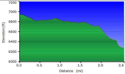
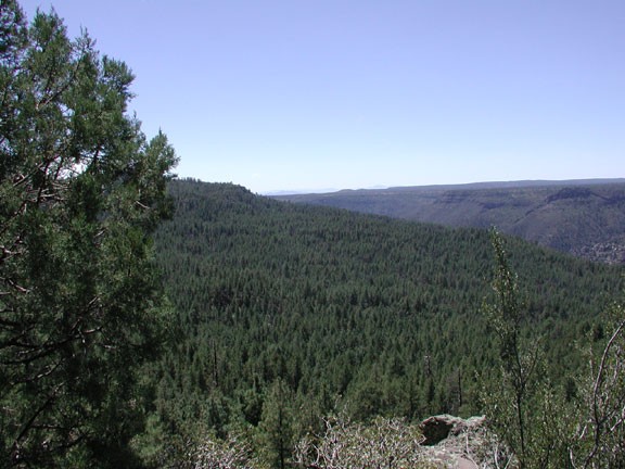
First I need to warn you about the drive. The road is really good until that last 0.65 miles. Drive slow and try not to puncture a tire or scrape the bottom of your automobile. After the long drive from Flagstaff, breathing in the clean air of the Sycamore Canyon wilderness area is welcome. This hike starts up on the rim and goes 600 ft into the canyon (but not to the bottom). The turn around point for this hike is Dorsey Spring.
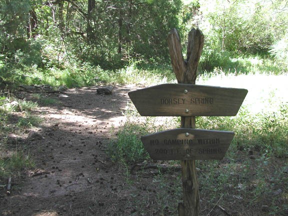
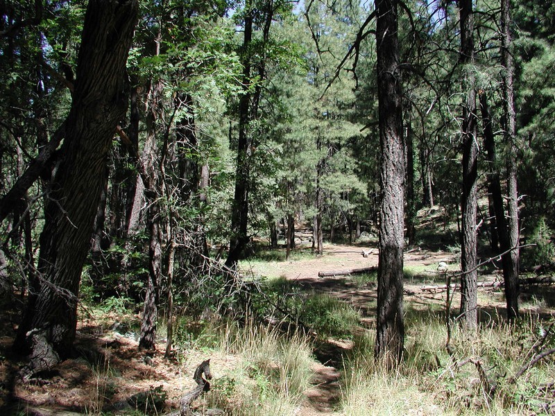
The well marked trailhead starts from the parking area. The trail follows an old (now closed) jeep road through a pine forest. Keep an eye out for deer here, as we spotted a few when we did this hike. After a mere 0.25 miles of hiking, you will reach signed fork. To the left is the Hog Hill trailhead to Winter Cabin. We will go right here to the Dorsey Spring Trail.
For the first 1.8 miles of this hike, the elevation stays mainly flat. Afterwards, you reach the rim, which is tantalizingly out of view because of the pine trees blocking the views. Here the trail starts down a drainage and begins to quickly loose elevation. Most of the 600 ft elevation loss is in the next 0.5 miles to Dorsey Spring.
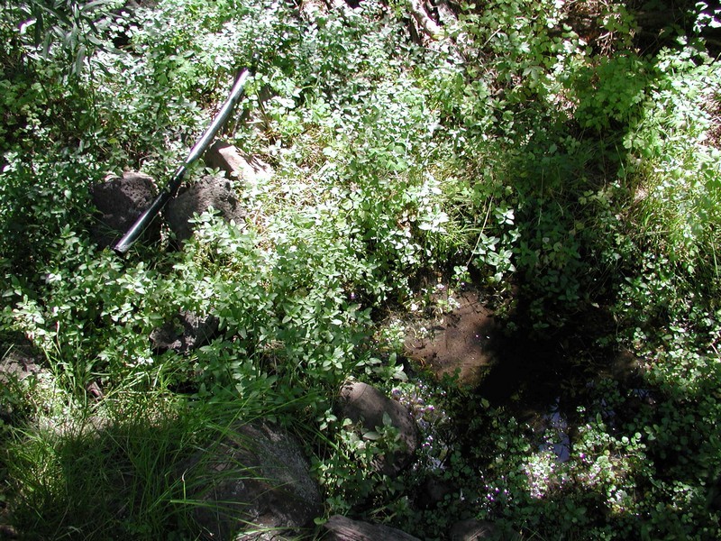
Dorsey Spring is well signed within a lovely clearing. The spring itself comes from a pipe buried in the spring.
This is a nice place to eat lunch and turn around. When we did this hike, the bugs were too active for our tastes, so we didn't spend much time exploring this area. Bringing Deet is a good rule of thumb when hiking in this area... just in case of the rare bad bug day.
Enjoy the heart pumping climb back up to the trailhead.
